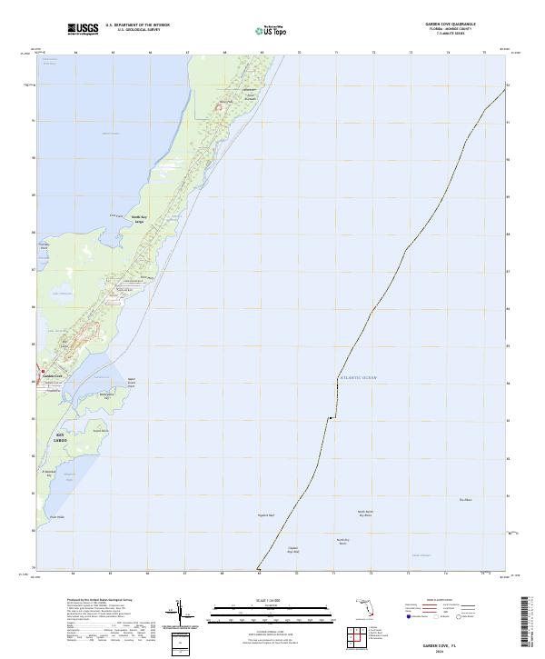
2024 Map of Garden Cove
USGS Topo · Published 2024About this map
The Crocodile Lake National Wildlife Refuge dominates the upper reaches of this island corridor, protecting a critical habitat of mangrove forests and salt marshes. The landscape is a complex network of waterways, where the Intracoastal Waterway and Barnes Sound meet the northern tip of Key Largo. While much of the land remains under conservation, residential pockets like Garden Cove and North Key Largo are visible, connected by Co Rd 905 and residential streets such as Charlemagne Blvd. Offshore, the environment transitions into the Atlantic Ocean and Hawk Channel, defined by subsurface features like Higdons Reef and North Dry Rocks. This survey illustrates the delicate balance between the 21st-century environmental preservation efforts and the established coastal settlements along the Florida Straits.
Find a feature on this map
43 named features on this map. Tap any name to fly to it.
Don’t see what you’re looking for? This feature index may not catch every label — zoom into the map to look around manually.
Map Details
Editions of this 2024 Garden Cove Map
This is the sole edition of this map. No revisions or reprints were ever made.
Other maps of this area

1947 · Garden Cove
USGS Topo · 1:24,000

1947 · Rock Harbor
USGS Topo · 1:24,000

1947 · Blackwater Sound
USGS Topo · 1:24,000

1949 · Blackwater Sound
USGS Topo · 1:24,000

1949 · Rock Harbor
USGS Topo · 1:24,000

1949 · Garden Cove
USGS Topo · 1:24,000

1949 · Card Sound
USGS Topo · 1:24,000

1949 · Pacific Reef
USGS Topo · 1:24,000

1950 · Glades
USGS Topo · 1:24,000

1956 · Card Sound
USGS Topo · 1:24,000