
1958 Map of Garden
USGS Topo · Published 1959About this map
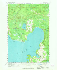
Big Bay de Noc dominates this mid-century view of the Garden Peninsula, where the timber and maritime economies of Delta County converge. The settlement of Nahma sits prominently on the western shore at the mouth of the Sturgeon River, while the village of Garden anchors the eastern side of the bay near Vans Harbor. The infrastructure of the era is clearly defined by the Minneapolis St Paul and Sault Ste Marie railroad, which cuts through the northern timberlands of the Hiawatha National Forest. Genealogists will find significant detail in the placement of community anchors like Bethany Ch, St Ann Ch, and numerous rural burial sites including Kates Bay Cem and Indian Point Cem. The map captures a landscape defined by its points and bays, from the height of Jacks Bluff to the specialized utility of the Moss Lake Lookout Tower.
Find a feature on this map
70 named features on this map. Tap any name to fly to it.
Don’t see what you’re looking for? This feature index may not catch every label — zoom into the map to look around manually.
Map Details
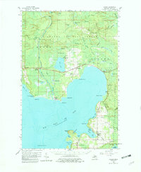
Editions of this 1958 Garden Map
3 editions found
Other maps of this area

1931 · Steuben SW
USGS Topo · 1:31,680

1931 · Cooks NW
USGS Topo · 1:31,680

1932 · Rapid River NE
USGS Topo · 1:31,680

1932 · Burnt Bluff NE
USGS Topo · 1:31,680

1932 · Burnt Bluff NW
USGS Topo · 1:31,680

1932 · Garden NW and SW
USGS Topo · 1:31,680

1932 · Skeels Lake SE
USGS Topo · 1:31,680

1932 · Garden SE
USGS Topo · 1:31,680

1932 · Trenary SE
USGS Topo · 1:31,680

1932 · Rapid River SE
USGS Topo · 1:31,680
Featured Places
- Nahma, Nahma Township
- Garden, Garden Township
- Fairbanks Township, MI
- Garden Township, MI
- Nahma Township, MI