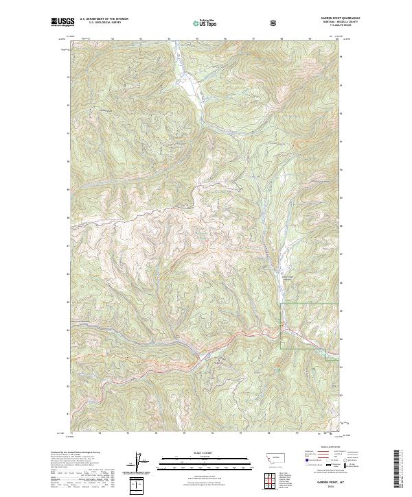
2024 Map of Garden Point
USGS Topo · Published 2024About this map
Lolo National Forest dominates this landscape, encompassing a complex network of ridgelines and drainages within the Bitterroot Mountains. The topography is defined by significant elevations such as Garden Point and Wagon Mountain, with the Grave Creek Range rising to the east. Historically significant corridors such as the Lolo Trl and the North Fork Howard Creek Trl indicate longstanding routes through these mountain passes. Drainage patterns are intricate, with Lolo Creek and Howard Creek flowing through the southern portion of the quadrangle, while Petty Creek and its various branches, including the South Fork Petty Creek, carve through the northern sections. This 2024 map documents a modern view of land management and recreational access, showing several snowmobile and pack trails that facilitate movement through the high-country meadows and gulches like Cooley Gulch and Chief Joseph Gulch.
Find a feature on this map
36 named features on this map. Tap any name to fly to it.
Don’t see what you’re looking for? This feature index may not catch every label — zoom into the map to look around manually.
Map Details
Editions of this 2024 Garden Point Map
This is the sole edition of this map. No revisions or reprints were ever made.
Other maps of this area

1911 · Lolo
USGS Topo · 1:250,000

1912 · Missoula
USGS Topo · 1:125,000

1913 · Lolo
USGS Topo · 1:250,000

1956 · Hamilton
USGS Topo · 1:250,000

1959 · Hamilton
USGS Topo · 1:250,000

1960 · Hamilton
USGS Topo · 1:250,000

1964 · Hamilton
USGS Topo · 1:250,000
1964 · Diamond Point
USGS Topo · 1:24,000

1964 · Lolo Hot Springs
USGS Topo · 1:24,000

1964 · Garden Point
USGS Topo · 1:24,000