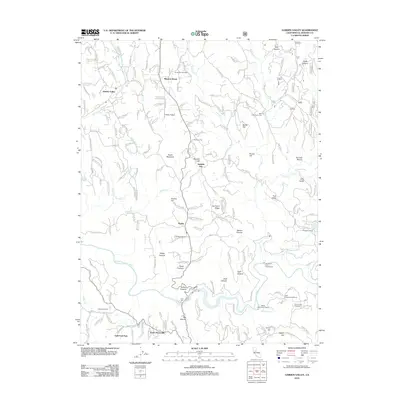
2012 Map of Garden Valley
USGS Topo · Published 2012About this map
Kelsey and Garden Valley anchor this landscape where the S Fork American River carves through deep terrain, including Big Canyon and Texas Canyon. The map records a transition from traditional agricultural and mining roots to modern land uses, evidenced by the presence of the JW Marshall Shop and the industrial infrastructure of the American River Powerhouse and White Rock Power House. Commercial viticulture is well-established here, with Jodar Vineyard and Winery and Granite Hills Vineyards marking the hillsides south of the river. To the north, smaller settlements like Spanish Flat and Meadow Brook are connected by a dense network of mountain roads such as Garden Valley Rd and Mule Ear Rd. Local landmarks like Dubey Airport and Finnon Reservoir provide specific points of reference for those studying the 21st-century development of this portion of El Dorado County.
Find a feature on this map
181 named features on this map. Tap any name to fly to it.
Don’t see what you’re looking for? This feature index may not catch every label — zoom into the map to look around manually.
Map Details
Editions of this 2012 Garden Valley Map
This is the sole edition of this map. No revisions or reprints were ever made.
Other maps of this area

1891 · Placerville
USGS Topo · 1:125,000

1892 · Placerville
USGS Topo · 1:125,000

1893 · Placerville
USGS Topo · 1:125,000

1947 · Sacramento
USGS Topo · 1:250,000

1948 · Sacramento
USGS Topo · 1:250,000

1949 · Georgetown
USGS Topo · 1:62,500

1949 · Placerville
USGS Topo · 1:62,500
1949 · Georgetown
USGS Topo · 1:24,000

1949 · Placerville
USGS Topo · 1:24,000
1949 · Coloma
USGS Topo · 1:24,000