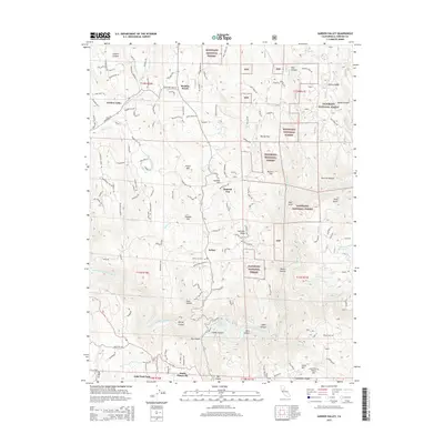
2015 Map of Garden Valley
USGS Topo · Published 2015About this map
The South Fork American River carves through the lower portion of this landscape, defining a region where Gold Rush-era history meets the conservation boundaries of the Eldorado National Forest. The map documents the residential and industrial character of El Dorado County, featuring the Black Oak Mine and the quiet grounds of Kelsey Cemetery near the settlement of Kelsey. To the north, the community of Garden Valley serves as a hub, surrounded by a network of winding roads like Greenwood Rd and Marshall Rd.
Find a feature on this map
109 named features on this map. Tap any name to fly to it.
Don’t see what you’re looking for? This feature index may not catch every label — zoom into the map to look around manually.
Map Details
Editions of this 2015 Garden Valley Map
This is the sole edition of this map. No revisions or reprints were ever made.
Other maps of this area

1891 · Placerville
USGS Topo · 1:125,000

1892 · Placerville
USGS Topo · 1:125,000

1893 · Placerville
USGS Topo · 1:125,000

1947 · Sacramento
USGS Topo · 1:250,000

1948 · Sacramento
USGS Topo · 1:250,000

1949 · Georgetown
USGS Topo · 1:62,500

1949 · Placerville
USGS Topo · 1:62,500
1949 · Georgetown
USGS Topo · 1:24,000

1949 · Placerville
USGS Topo · 1:24,000
1949 · Coloma
USGS Topo · 1:24,000