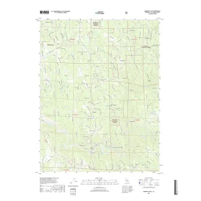
2018 Map of Garden Valley
USGS Topo · Published 2018About this map
Kelsey and Garden Valley anchor this portion of El Dorado County, where the foothills rise into the Eldorado National Forest. The landscape is defined by a dense network of canyons and gulches, including Ladies Canyon, Big Canyon, and Texas Canyon, all descending toward the South Fork American River in the south. The area's settlement history is evident in named landmarks like Kelsey Cem and Spanish Hill, while the local topography is traced through prominent features such as Laumann Ridge and Darling Ridge.
Find a feature on this map
175 named features on this map. Tap any name to fly to it.
Don’t see what you’re looking for? This feature index may not catch every label — zoom into the map to look around manually.
Map Details
Editions of this 2018 Garden Valley Map
This is the sole edition of this map. No revisions or reprints were ever made.
Other maps of this area

1891 · Placerville
USGS Topo · 1:125,000

1892 · Placerville
USGS Topo · 1:125,000

1893 · Placerville
USGS Topo · 1:125,000

1947 · Sacramento
USGS Topo · 1:250,000

1948 · Sacramento
USGS Topo · 1:250,000

1949 · Georgetown
USGS Topo · 1:62,500

1949 · Placerville
USGS Topo · 1:62,500
1949 · Georgetown
USGS Topo · 1:24,000

1949 · Placerville
USGS Topo · 1:24,000
1949 · Coloma
USGS Topo · 1:24,000