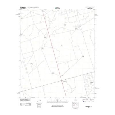
2010 Map of Gardendale
USGS Topo · Published 2010About this map
Gardendale sits at the heart of this Permian Basin landscape, representing a characteristic West Texas pattern of dispersed rural residential development and agricultural enterprise. The map reveals an environment where water access is the primary driver of settlement, evidenced by the high density of named water features like Steel Tower Windmill, Mutt Windmill, and Ward Windmill. These landmarks serve as vital geographical anchors for the surrounding ranching and industrial operations. North of the larger settlement, the Circle Bar Ranch and Scharbauer City mark significant nodes of local activity, while a grid of roads including Marion Flint and N Aster Ave provides the framework for this sparsely populated region. The numbered series of structures, such as Windmill Number Twelve and Windmill Number Ten, suggests an organized, large-scale approach to land and resource management during this era.
Find a feature on this map
17 named features on this map. Tap any name to fly to it.
Don’t see what you’re looking for? This feature index may not catch every label — zoom into the map to look around manually.
Map Details
Editions of this 2010 Gardendale Map
This is the sole edition of this map. No revisions or reprints were ever made.
Other maps of this area

1954 · Hobbs
USGS Topo · 1:250,000

1954 · Pecos
USGS Topo · 1:250,000

1957 · Pecos
USGS Topo · 1:250,000

1958 · Hobbs
USGS Topo · 1:250,000

1964 · Odessa NE
USGS Topo · 1:24,000

1964 · Odessa NW
USGS Topo · 1:24,000

1965 · Goldsmith
USGS Topo · 1:24,000

1967 · North Cowden
USGS Topo · 1:24,000

1968 · Baird Lake
USGS Topo · 1:24,000

1968 · Gardendale NW
USGS Topo · 1:24,000