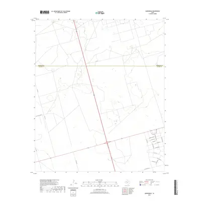
2019 Map of Gardendale
USGS Topo · Published 2019About this map
The Andrews Co and Ector Co boundary line divides this West Texas landscape, where modern residential development meets the open ranchland and utility corridors of the Permian Basin. In the southeast, the residential grid of Gardendale expands with flower-named streets such as Morning Glory Rd, Camelia Dr, and E Goldenrod Dr. This suburban cluster contrasts sharply with the western portion of the quadrangle, which is defined by long, straight thoroughfares including Co Hwy 26 and Boy Scouts Ranch Rd. The presence of Wire Line Rd and Se 9400 underscores the area's infrastructure-heavy character, serving the various industrial and ranching interests that have long shaped the region's economy.
Find a feature on this map
22 named features on this map. Tap any name to fly to it.
Don’t see what you’re looking for? This feature index may not catch every label — zoom into the map to look around manually.
Map Details
Editions of this 2019 Gardendale Map
This is the sole edition of this map. No revisions or reprints were ever made.
Other maps of this area

1954 · Hobbs
USGS Topo · 1:250,000

1954 · Pecos
USGS Topo · 1:250,000

1957 · Pecos
USGS Topo · 1:250,000

1958 · Hobbs
USGS Topo · 1:250,000

1964 · Odessa NE
USGS Topo · 1:24,000

1964 · Odessa NW
USGS Topo · 1:24,000

1965 · Goldsmith
USGS Topo · 1:24,000

1967 · North Cowden
USGS Topo · 1:24,000

1968 · Baird Lake
USGS Topo · 1:24,000

1968 · Gardendale NW
USGS Topo · 1:24,000