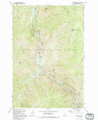
1991 Map of Gardiner Peak
USGS Topo · Published 1994About this map
Middle Fork Clearwater River and the Selway River converge in this remote wilderness corridor, carving through the high country of the Nez Perce National Forest and the Bitterroot National Forest. The landscape is defined by its protected status, falling within the Selway-Bitterroot Wilderness where human infrastructure is limited to isolated outposts and riverside clearings. Small aviation-dependent settlements and administrative points like the Shearer Guard Station, North Star Ranch, and Running Creek Ranch dot the riverbanks, often accompanied by a primitive Landing Strip for access. Significant elevations like Gardiner Peak and Elevator Mtn overlook a complex network of drainages, including Gardiner Creek and Running Creek. The area maintains its primitive character, with the Wild and Scenic River Boundary safeguarding the river's path through points such as Waldo Bar.
Find a feature on this map
28 named features on this map. Tap any name to fly to it.
Don’t see what you’re looking for? This feature index may not catch every label — zoom into the map to look around manually.
Map Details
Editions of this 1991 Gardiner Peak Map
This is the sole edition of this map. No revisions or reprints were ever made.
Other maps of this area

1911 · Lolo
USGS Topo · 1:250,000

1913 · Lolo
USGS Topo · 1:250,000

1956 · Elk City
USGS Topo · 1:250,000

1956 · Hamilton
USGS Topo · 1:250,000

1959 · Hamilton
USGS Topo · 1:250,000

1960 · Elk City
USGS Topo · 1:250,000

1960 · Hamilton
USGS Topo · 1:250,000

1964 · Hamilton
USGS Topo · 1:250,000

1966 · Spot Mountain
USGS Topo · 1:24,000

1966 · Twin Butte
USGS Topo · 1:24,000