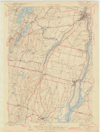
1980 Map of Gardiner
USGS Topo · Published 1991About this map
The Kennebec River corridor defines the eastern edge of this 1941 survey, showing the busy Maine Central Railroad connecting settlements like Richmond and South Gardiner. The landscape is a network of small agricultural and milling hamlets, many centered around specific intersections like Litchfield Cors, Richmond Cor, and Spears Cor. These communities were served by a dense system of rural schoolhouses, including McKinley Sch and Waterman Sch, which are clearly marked alongside family-named cemeteries such as Plumer Cem and Reed Cem.
Find a feature on this map
106 named features on this map. Tap any name to fly to it.
Don’t see what you’re looking for? This feature index may not catch every label — zoom into the map to look around manually.
Map Details
Editions of this 1980 Gardiner Map
This is the sole edition of this map. No revisions or reprints were ever made.
Other maps of this area

1892 · Gardiner
USGS Topo · 1:62,500

1892 · Freeport
USGS Topo · 1:62,500

1892 · Augusta
USGS Topo · 1:62,500

1893 · Vassalboro
USGS Topo · 1:62,500

1893 · Wiscasset
USGS Topo · 1:62,500

1893 · Boothbay
USGS Topo · 1:62,500

1894 · Bath
USGS Topo · 1:62,500

1898 · Vassalboro
USGS Topo · 1:62,500

1908 · Lewiston
USGS Topo · 1:62,500

1910 · Livermore
USGS Topo · 1:62,500