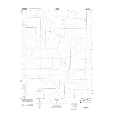
2012 Map of Garland
USGS Topo · Published 2012About this map
Garland and Oskaloosa anchor this rural landscape along the Kansas-Missouri border, where the terrain is defined by the winding course of Dry Wood Cr. The map reveals a dense network of local history through its numerous burial sites, including McKill Chapel Cem, Heavisides Cem, and Shiloh Cem, which suggest long-established family ties to these prairie lands. Two prominent topographic landmarks, Martin Mound in the northeast and Blue Mound near the southern border, rise above the surrounding creek valleys. The water system is particularly complex here, with W Fork Dry Wood Cr and McKill Cr feeding into the main channel. At the southern edge, the Arcadia Wastewater Treatment Facility and the small settlement of Le Roy indicate the localized infrastructure serving the nearby population.
Find a feature on this map
37 named features on this map. Tap any name to fly to it.
Don’t see what you’re looking for? This feature index may not catch every label — zoom into the map to look around manually.
Map Details
Editions of this 2012 Garland Map
This is the sole edition of this map. No revisions or reprints were ever made.
Other maps of this area

1884 · Fort Scott
USGS Topo · 1:125,000

1886 · Nevada
USGS Topo · 1:125,000

1886 · Fort Scott
USGS Topo · 1:125,000

1893 · Fort Scott
USGS Topo · 1:125,000

1894 · Nevada
USGS Topo · 1:125,000

1939 · Deerfield
USGS Topo · 1:24,000

1939 · Moundville
USGS Topo · 1:24,000

1942 · Deerfield
USGS Topo · 1:24,000
1942 · Moundville
USGS Topo · 1:24,000

1947 · Joplin
USGS Topo · 1:250,000