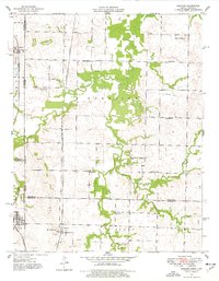
1948 Map of Garland
USGS Topo · Published 1977About this map
The Kansas City Southern and St Louis - San Francisco railroads anchor this landscape along the Kansas-Missouri border, connecting the rail towns of Garland and Arcadia. The terrain is defined by extractive industry and rural community life, where numerous sites marked Strip Mine underscore the region's coal-mining activity. These excavations weave between a dense network of one-room schoolhouses, including Glenwood Sch, Totten Sch, and Belmont Sch, which served the dispersed farming families of Harrison and Leroy townships. Notable landmarks like Blue Mound and Martin Mound rise above the drainage basins of West Fork Dry Wood Creek and McKill Creek. This mapping, based on 1939 aerial photography and 1948 field methods, captures a specific era of mid-century Midwestern land use before modern agricultural consolidation changed the footprint of these local centers.
Find a feature on this map
31 named features on this map. Tap any name to fly to it.
Don’t see what you’re looking for? This feature index may not catch every label — zoom into the map to look around manually.
Map Details
Editions of this 1948 Garland Map
This is the sole edition of this map. No revisions or reprints were ever made.
Other maps of this area

1884 · Fort Scott
USGS Topo · 1:125,000

1886 · Nevada
USGS Topo · 1:125,000

1886 · Fort Scott
USGS Topo · 1:125,000

1893 · Fort Scott
USGS Topo · 1:125,000

1894 · Nevada
USGS Topo · 1:125,000

1939 · Deerfield
USGS Topo · 1:24,000

1939 · Moundville
USGS Topo · 1:24,000

1942 · Deerfield
USGS Topo · 1:24,000
1942 · Moundville
USGS Topo · 1:24,000

1947 · Joplin
USGS Topo · 1:250,000