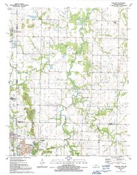
1991 Map of Garland
USGS Topo · Published 1991About this map
The borderlands of Bourbon and Crawford Counties in Kansas meet Vernon and Barton Counties in Missouri along the winding course of Dry Wood Creek. This rural landscape, documented just before the turn of the 21st century, is defined by small agricultural settlements and a network of family and community landmarks. The town of Garland sits near the northern edge of the sheet, while Arcadia and the smaller Oskaloosa anchor the southern reach. The terrain is marked by distinctive elevations like Blue Mound and Martin Mound, which overlook a quilt of section lines and secondary roads. For those tracing local history, the map preserves the locations of several community cemeteries, including Shiloh Cem, Heaviside Cem, and Leroy Cem, along with McKill Chapel, serving as a vital record of the area's social and geographic layout at this time.
Find a feature on this map
25 named features on this map. Tap any name to fly to it.
Don’t see what you’re looking for? This feature index may not catch every label — zoom into the map to look around manually.
Map Details
Editions of this 1991 Garland Map
This is the sole edition of this map. No revisions or reprints were ever made.
Other maps of this area

1884 · Fort Scott
USGS Topo · 1:125,000

1886 · Nevada
USGS Topo · 1:125,000

1886 · Fort Scott
USGS Topo · 1:125,000

1893 · Fort Scott
USGS Topo · 1:125,000

1894 · Nevada
USGS Topo · 1:125,000

1939 · Deerfield
USGS Topo · 1:24,000

1939 · Moundville
USGS Topo · 1:24,000

1942 · Deerfield
USGS Topo · 1:24,000
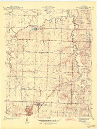
1942 · Moundville
USGS Topo · 1:24,000

1947 · Joplin
USGS Topo · 1:250,000