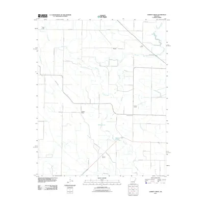
2011 Map of Garrett Grove
USGS Topo · Published 2011About this map
Garrett Grove and Hopper form the primary points of settlement in this rural Lee County landscape during the early 21st century. The terrain is defined by a complex network of waterways, including the winding course of Big Creek and Flat Fork Creek, which feed into localized bodies of water such as Whistling Lake and Walnut Lake. The area's social history is recorded through its many family and community burial grounds, which are distributed across the sectioned farm plots.
Find a feature on this map
44 named features on this map. Tap any name to fly to it.
Don’t see what you’re looking for? This feature index may not catch every label — zoom into the map to look around manually.
Map Details
Editions of this 2011 Garrett Grove Map
This is the sole edition of this map. No revisions or reprints were ever made.
Other maps of this area

1940 · Marvell
USGS Topo · 1:62,500

1940 · Holly Grove
USGS Topo · 1:62,500

1940 · Brinkley
USGS Topo · 1:62,500

1940 · Marianna
USGS Topo · 1:62,500

1948 · Helena
USGS Topo · 1:250,000

1950 · Helena
USGS Topo · 1:250,000

1955 · Helena
USGS Topo · 1:250,000

1956 · Marvell
USGS Topo · 1:62,500
1957 · Marianna
USGS Topo · 1:62,500

1957 · Holly Grove
USGS Topo · 1:62,500