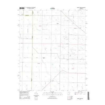
2014 Map of Garrett Grove
USGS Topo · Published 2014About this map
Garrett Grove and Hopper anchor this agricultural landscape in eastern Arkansas, where the borders of Lee, Monroe, and St. Francis counties meet. The area is defined by an intricate network of waterways, including the winding course of Big Creek and the drainage systems of Flat Fork Cr, Little Piney Cr, and Big Piney Cr. A significant number of family and community burial grounds are found throughout the quadrangle, such as Garrett Cem and Taylor Cem, providing valuable touchpoints for genealogists researching the residents of these delta townships. Small bodies of water like Whistling Lake and Walnut Lake dot the low-lying terrain, while a dense grid of county roads, including Mobbley Rd and Lee 918 Rd, connects the scattered farmsteads and rural homesites characteristic of the region's contemporary rural structure.
Find a feature on this map
59 named features on this map. Tap any name to fly to it.
Don’t see what you’re looking for? This feature index may not catch every label — zoom into the map to look around manually.
Map Details
Editions of this 2014 Garrett Grove Map
This is the sole edition of this map. No revisions or reprints were ever made.
Other maps of this area

1940 · Marvell
USGS Topo · 1:62,500

1940 · Holly Grove
USGS Topo · 1:62,500

1940 · Brinkley
USGS Topo · 1:62,500

1940 · Marianna
USGS Topo · 1:62,500

1948 · Helena
USGS Topo · 1:250,000

1950 · Helena
USGS Topo · 1:250,000

1955 · Helena
USGS Topo · 1:250,000

1956 · Marvell
USGS Topo · 1:62,500
1957 · Marianna
USGS Topo · 1:62,500

1957 · Holly Grove
USGS Topo · 1:62,500