Loading...
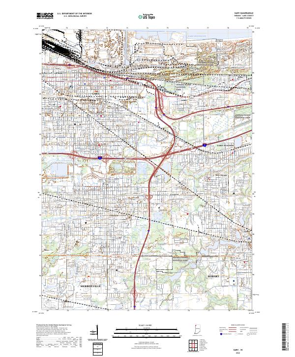
Loading map...2022 Map of Gary
USGS Topo · Published 2022About this map
Indiana Dunes National Park and the industrial corridors of the Grand Calumet River define this map's landscape at the southern tip of Lake Michigan. The settlement patterns show the dense residential grids of Gary and its neighborhood cores like Tolleston, Miller, and Aetna, transitioning into the suburban developments of Merrillville and Hobart.
Find a feature on this map
44 named features on this map. Tap any name to fly to it.
Don’t see what you’re looking for? This feature index may not catch every label — zoom into the map to look around manually.
Map Details
Date Portrayed2022
Date Published2022
PublisherU.S. Geological Survey
Map TypeTopographic
Scale1:24000
Physical Dimensions24 x 29 inches
Editions of this 2022 Gary Map
This is the sole edition of this map. No revisions or reprints were ever made.
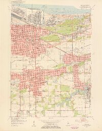
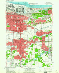
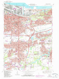
Historical Maps of Glen Ryan Through Time
5 maps found

Featured Locations
Source Details
SourceU.S. Geological Survey
CopyrightPublic Domain