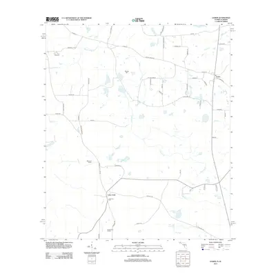
2012 Map of Gaskin
USGS Topo · Published 2012About this map
Gaskin anchors this northern Walton County landscape, a rural community defined by a complex network of wetlands and small water bodies. The geography is notably punctuated by numerous named ponds, such as Punch Bowl Pond and E H Myers Pond, which alongside Eightmile Cr and Natural Bridge Cr, create a pattern of drainage through the pine woods and farmland. Aviation markers like Melanie's Airport and Bunge Farm Airport suggest a modern agricultural or private transport utility in this quiet corner of the Florida panhandle.
Find a feature on this map
57 named features on this map. Tap any name to fly to it.
Don’t see what you’re looking for? This feature index may not catch every label — zoom into the map to look around manually.
Map Details
Editions of this 2012 Gaskin Map
This is the sole edition of this map. No revisions or reprints were ever made.
Other maps of this area

1949 · Glendale
USGS Topo · 1:62,500

1949 · Laurel Hill
USGS Topo · 1:62,500

1950 · Laurel Hill
USGS Topo · 1:62,500

1951 · Glendale
USGS Topo · 1:62,500

1953 · Andalusia
USGS Topo · 1:250,000

1957 · Andalusia
USGS Topo · 1:250,000

1957 · Pensacola
USGS Topo · 1:250,000

1959 · Pensacola
USGS Topo · 1:250,000

1960 · Pensacola
USGS Topo · 1:250,000
1968 · Samson
USGS Topo · 1:24,000