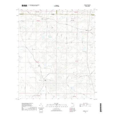
2018 Map of Gaskin
USGS Topo · Published 2018About this map
Gaskin and the settlement of Caney Creek anchor this landscape along the border of Florida and Alabama. The terrain is characterized by a high density of small ponds and marshy lowlands, including Big Swamp and the Big Swamp Annex. Named water features like Punch Bowl Pond, Adams Pond, and Deurell Pond dot the map, while Eightmile Cr and Natural Bridge Cr drain the sandy soils of northern Walton County.
Find a feature on this map
79 named features on this map. Tap any name to fly to it.
Don’t see what you’re looking for? This feature index may not catch every label — zoom into the map to look around manually.
Map Details
Editions of this 2018 Gaskin Map
This is the sole edition of this map. No revisions or reprints were ever made.
Other maps of this area
1949 · Glendale
USGS Topo · 1:62,500
1949 · Laurel Hill
USGS Topo · 1:62,500
1950 · Laurel Hill
USGS Topo · 1:62,500
1951 · Glendale
USGS Topo · 1:62,500
1953 · Andalusia
USGS Topo · 1:250,000
1957 · Andalusia
USGS Topo · 1:250,000
1957 · Pensacola
USGS Topo · 1:250,000
1959 · Pensacola
USGS Topo · 1:250,000
1960 · Pensacola
USGS Topo · 1:250,000
1968 · Samson
USGS Topo · 1:24,000