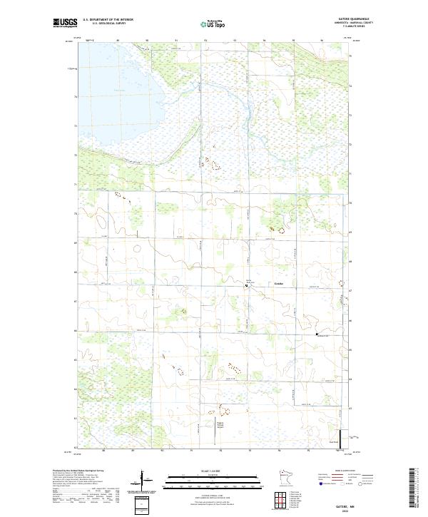
2022 Map of Gatzke
USGS Topo · Published 2022About this map
Gatzke serves as the central hub of this northern Minnesota landscape, where the agricultural grid meets the sprawling wetlands of the northwest. The terrain is defined by its water systems, most notably the broad expanse of Thief Lake in the northwest and the winding course of the Moose River. These waterways, along with Webster Cr, dictate the drainage of a region largely organized into a systematic township and range system. Local heritage is preserved at sites like Moose River Cem and Lundsted Cem, which are situated along the rural road network that connects scattered homesteads and fields. Aviation markers such as Hagens Private Airport and Paul Field indicate the importance of private air travel in navigating this expansive territory during the early twenty-first century.
Find a feature on this map
30 named features on this map. Tap any name to fly to it.
Don’t see what you’re looking for? This feature index may not catch every label — zoom into the map to look around manually.
Map Details
Editions of this 2022 Gatzke Map
This is the sole edition of this map. No revisions or reprints were ever made.
Other maps of this area

1918 · Rollis
USGS Topo · 1:62,500

1918 · Pencer
USGS Topo · 1:62,500

1918 · Garland
USGS Topo · 1:62,500

1919 · Liner
USGS Topo · 1:62,500

1943 · Rollis
USGS Topo · 1:62,500

1954 · Roseau
USGS Topo · 1:250,000

1957 · Roseau
USGS Topo · 1:250,000

1958 · Roseau
USGS Topo · 1:250,000
1962 · Gatzke NW
USGS Topo · 1:24,000

1962 · Gatzke SE
USGS Topo · 1:24,000