Old Maps of Marshall County, Minnesota
Explore 374 old maps of Marshall County, spanning from 1918 to today. These high-resolution historic maps reveal how streets, neighborhoods, landmarks, and natural features evolved over time — perfect for genealogy, metal detecting, research, and local history exploration.
What you can do with these maps:
- See how Marshall County changed over time: Compare historical maps to modern-day views to trace roads, homesites, rail lines & more.
- View detailed metadata: Each map includes creators, publishers, year, scale, and archive source.
- Overlay maps with satellite & LiDAR: Visualize the past alongside modern tools to explore terrain & human change.
- Trusted historical sources: Maps sourced from the USGS, Library of Congress, and other archives.
- Access maps your way: View online, download high-res files, or order prints for personal or research use.
Start exploring old maps of Marshall County to uncover forgotten places, hidden landmarks, and the deep history beneath your feet.
Marshall County, MN maps
(374)- 1918 Map of Rollis
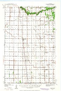
 1918 Rollis1918 Print · USGSMarshall County's northern wetlands are documented here just after the war, showing a landscape defined by drainage projects and new settlements. Genealogists can locate family ties at Gatzke, Jonstad, or the Town Hall near Rollis, while tracing the Old Indian Reservation Boundary Line.
 - 1918 Map of Angus
 1918 Angus1918 Print · USGSThe Red River Valley's agricultural landscape is documented here during the Great War era, showing a region defined by rail lines and grain elevators. Family historians can trace rural property through schools and specific landmarks like the Lone Elevator and Cem. near Radium.
 - 1918 Map of Pencer
 1918 Pencer1918 Print · USGSNorthern Minnesota's borderlands appear in the late nineteen-teens as a landscape of timbered swamps and new drainage districts. Genealogists and local researchers can trace early rural life through scattered settlements like Pencer, Wannaska, and Casperson, or locate the Old Indian Reservation Boundary Line.
 - 1918 Map of Acton
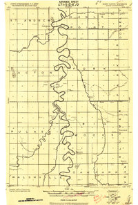 1918 Acton1918 Print · USGSThe Red River Valley's winding borderlands are captured here during the First World War, showing the transition from wild wetlands to managed farmland. Genealogists can trace small settlements and rural schoolhouses like Acton, Bigwoods, and St. Andrews.
 - 1918 Map of Garland
 1918 Garland1918 Print · USGSNorthern Minnesota borderlands during the First World War reveal a landscape of drainage ditches and early rural post offices. Genealogists can locate long-vanished sites like P.O. Garland and Homolka P.O. or trace the Old Indian Reservation Boundary Line.
 - 1918 Map of Argyle
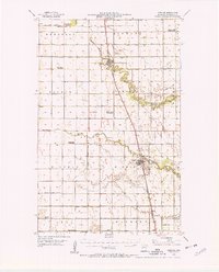
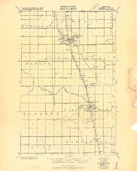 1918 Argyle1918 Print · USGSPrairie life in Marshall County thrives during the late teens as railroads and drainage ditches reshape the land. Genealogists can trace family footprints near Argyle, Stephen, and the Luna elevator, or locate rural landmarks like the Argyle tallest church spire.
 - 1918 Map of Viking, 1943 Print
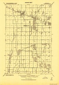 1918 Viking1943 Print · USGSNorthwestern Minnesota at the end of the Great War is captured here as a grid of drainage ditches and emerging rail towns. Genealogists can locate family landmarks including the Cem. near Rosewood, the settlement of Bray, and more than a dozen rural schools.
 - 1918 Map of Greenbush, 1943 Print
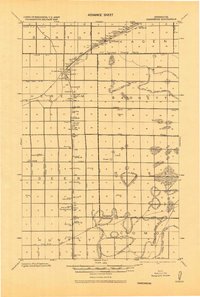 1918 Greenbush1943 Print · USGSNorthern Minnesota farming and drainage districts are captured in the late teens as the Great Northeastern railroad connects Greenbush and Strathcona. Genealogists can trace early homestead life via rural landmarks like School 34, Herb, and the Cem. near the county line.
 - 1918 Map of Warren, 1943 Print
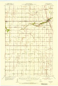
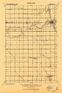 1918 Warren1943 Print · USGSThe northern Minnesota prairie at the end of the Great War was a landscape of pioneering drainage projects and emerging rail towns. Genealogists can trace family footprints through the Warren Courthouse Tower, local School sites, and early grain stops like the Sherack Tall Elevator.
 - 1918 Map of Middle River, 1943 Print
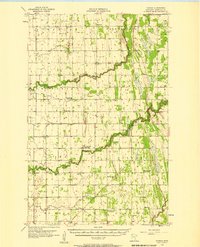
 1918 Middle River1943 Print · USGSThe Marshall County plains are shown during a period of intense drainage and development in the early twentieth century. Genealogists and historians can locate early settlements like Holt and Ringbo P.O. or trace the path of the Northern Pacific railroad.
 - 1919 Map of Liner
 1919 Liner1919 Print · USGSNorthern Minnesota during the drainage era comes into focus on this 1919 survey, showing the extensive ditching projects designed to reclaim the marshlands. Researchers can trace early schools and settlements like Grygla, Randen, and Liner along the Moose River.
 - 1919 Map of Pelan
 1919 Pelan1919 Print · USGSNorthwestern Minnesota at the close of the Great War was a landscape defined by massive drainage projects. Researchers can trace the early townships of Pelan and Linda, identifying the locations of numerous rural Schools and local hubs like Sanwick.
 - 1939 Map of Drayton, 1954 Print
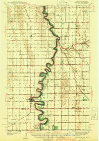
 1939 Drayton1954 Print · USGSThe Red River valley at the onset of the Second World War shows a landscape defined by tight river bends and a thriving railroad economy. Genealogists and local historians can trace family locations near dozens of rural schools and churches like Daymon Sch, Tabitha Ch, and the settlement of Bowesmont.2 unique versions available
 - 1939 Map of Kennedy, 1963 Print
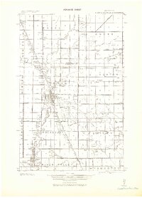
 1939 Kennedy1963 Print · USGSUpper Minnesota prairie life is centered on the Great Northern railroad in the years before the war. Genealogists and local historians can trace family roots through numerous country schools and churches like McKinley Sch, Happy Corner, and Enok Ch.2 unique versions available
 - 1941 Map of Kennedy
 1941 Kennedy1941 Print · USGSNorthwest Minnesota farming life is centered on the rail corridor during the late 1930s. Genealogists and historians can trace the foundations of rural society through landmarks like West Emmaus Ch, Happy Corner, and the Whalen Sch.
 - 1941 Map of Drayton
 1941 Drayton1941 Print · USGSThe Red River of the North snakes across the border of North Dakota and Minnesota during the late 1930s. Genealogists and historians can trace rail-side towns like Bowesmont and Drayton, or locate rural landmarks such as Skjeberg Ch and the Airway Beacon.2 unique versions available
 - 1943 Map of Rollis
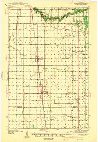
 1943 Rollis1943 Print · USGSMarshall County's rural townships are documented here during the first half of the twentieth century, showing a landscape defined by drainage engineering and early settlement. Researchers can trace family roots through numerous schools and churches or locate original township sites like Gatzke, Jonstad, and the Old Indian Reservation Boundary Line.
 - 1943 Map of Thief River Falls
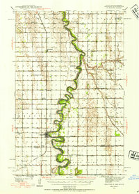
 1943 Thief River Falls1943 Print · USGSPennington County during the Second World War shows a landscape defined by the convergence of major rail lines and the drainage of the Red River Valley. Genealogists and historians can trace rail stops and rural landmarks like Steiner, St. Hilaire, and Church Cem.
 - 1952 Map of Thief River Falls, 1967 Print
 1952 Thief River Falls1967 Print · USGSThe Red River Valley's agricultural and conservation landscape is captured in the mid-1950s, detailing a web of rail lines and international border crossings. Researchers can trace family roots in towns like Thief River Falls, locate the State School for Blind, and survey landmarks like the Agassiz National Wildlife Refuge.2 unique versions available
 - 1954 Map of Stephen, 1955 Print
 1954 Stephen1955 Print · USGSMarshall County's Red River Valley landscape is shown here during a period of rural consolidation in the mid-fifties. Genealogists can trace former country school sites like LaVine Sch and School No 70 or locate the St Stephen Cem.2 unique versions available
 - 1954 Map of Roseau, 1969 Print
 1954 Roseau1969 Print · USGSNorthern Minnesota's borderlands come alive in the 1950s, showing a landscape defined by timber, water, and rail. Trace family roots through old schools and cemeteries near Roseau, Warroad, and the expansive Red Lake Indian Reservation.2 unique versions available
 - 1955 Map of Warren, 1956 Print
 1955 Warren1956 Print · USGSThe Red River Valley's agricultural heartland is documented here in the mid-fifties, centered on the rail crossroads of Warren. Genealogists can trace rural family roots through an extensive network of schoolhouses like Sandsville Sch and cemeteries such as Nyskoga Cem.
 - 1956 Map of Thief River Falls
 1956 Thief River Falls1956 Print · USGSThe Red River Valley in the mid-1950s is captured here as a sprawling network of rail corridors and wildlife refuges along the Canadian border. Trace the vanished transport routes of the Dismantled railroad and Abandoned railroad or locate local landmarks like the Herrick Elevator and State School for Blind.
 - 1956 Map of Karlstad, 1958 Print
 1956 Karlstad1958 Print · USGSNorthwestern Minnesota in the mid-fifties is captured here as a grid of grain-country townships connected by the Soo Line. Trace the rural development of the era through sites like Lake Bronson State Park, Bepson Sch, and Hegland Ch.2 unique versions available
 - 1956 Map of Florian, 1958 Print
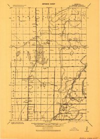
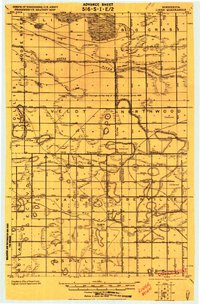
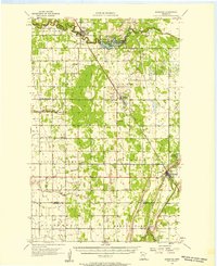
 1956 Florian1958 Print · USGSMarshall County’s prairie landscape is captured here in the mid-fifties, defined by the winding paths of the Tamarac River and Middle River. Genealogists can trace early rural life through numerous sites like Alma Ch, Englund, and Woodland Sch.
Showing maps 1-25 of 374
Top cities of Marshall County
- Warren historical maps
- Stephen historical maps
- Argyle historical maps
- Alvarado historical maps
- Newfolden historical maps
- Oslo historical maps
See more
Frequently asked questions
- What are the different types of historical maps available for Marshall County?
- What is the oldest map of Marshall County?
- Where can I purchase historical maps of Marshall County for my home or office?
- Where can I download high-res historical maps of Marshall County?
- Are there historical topographic maps available for Marshall County?
- Is there historical aerial imagery available for Marshall County?
- Where are historical maps of Marshall County sourced from?