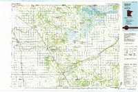
1980s Maps of Marshall County, Minnesota
Explore 22 historic maps of Marshall County from the 1980s. These maps offer a rare glimpse into what life looked like during the 1980s — showing old roads, neighborhoods, homes, and landmarks that have changed or disappeared over time.
Whether you're researching your family's past, planning a metal detecting trip, or studying how Marshall County's landscape evolved across the 1980s, these high-resolution maps are a powerful tool for exploring the history of this region.
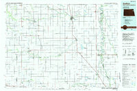
- Focus on a specific era: All maps on this page are from the 1980s, giving you a focused view of this time period.
- See what’s changed: Compare century-old streets, trails, and buildings to today's modern landscape using overlays and satellite layers.
- Research with precision: Use these maps for genealogy, historical research, land use analysis, or educational projects.
- View, download, or print: Maps are fully viewable online in high resolution, and can be downloaded or printed for your own records.
Start exploring Marshall County's history through authentic maps from the 1980s. This is your window into the past.
Marshall County, MN maps
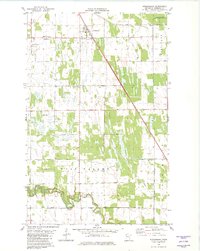
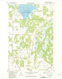
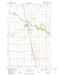
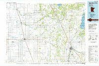
(22)- 1982 Map of Warren
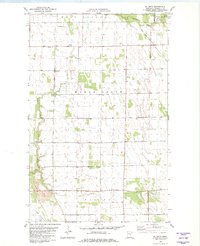
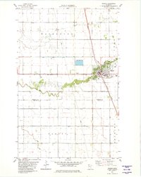 1982 Warren1982 Print · USGSThe rail-centered town of Warren and its surrounding townships are captured here in the early eighties. Genealogists and local historians can trace the intersection of the Burlington Northern and Soo Line, locate the community Cem, or find family landmarks like the Townhall and Melgard Coulee.
 - 1982 Map of Alvarado
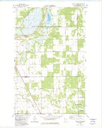
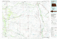
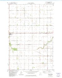 1982 Alvarado1982 Print · USGSAlvarado and its surrounding townships in the Red River Valley are documented here in the early eighties. Local researchers can trace the Soo Line railroad and locate family landmarks like Oak Lawn Cem, Vega Cem, and the Townhall in Sandsville.
 - 1982 Map of Florian SE
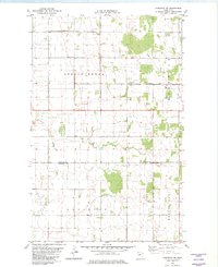
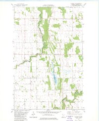
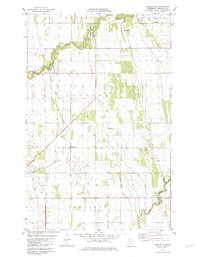 1982 Florian SE1982 Print · USGSMarshall County's rural townships are documented in the early 1980s, centered on the river valleys of the Red River basin. Researchers can locate the Foldahl Cem and Township Cem, or trace the recreational grounds of Old Mill State Park along the Middle River.
 - 1982 Map of Pelan SE
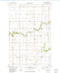
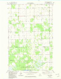 1982 Pelan SE1982 Print · USGSThe rural borderlands of Roseau and Marshall County are captured here in the early 1980s, defined by a vast drainage network. Local historians can trace family ties at Bethlehem Ch and its Cem, or locate the civic center at the nearby Townhall.
 - 1982 Map of Strandquist
 1982 Strandquist1982 Print · USGSStrandquist and the surrounding Marshall County townships are shown here in the early eighties as a landscape of structured prairie farming and immigrant heritage. Genealogists can locate several denominational burial sites, such as the Norwegian Cem and Mission Covenant Cem, alongside the Soo Line railroad.
 - 1982 Map of Florian SW
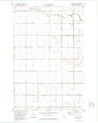
 1982 Florian SW1982 Print · USGSMarshall County's rural townships were captured in the early eighties as a network of farmsteads and drainage systems. Genealogists and local historians can locate the St Johns Ch, Mc Crea Cem, and the Townhall among the reaches of the Middle River.
 - 1982 Map of Karlstad
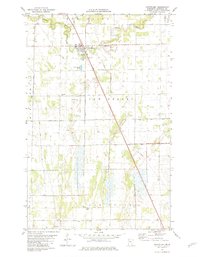
 1982 Karlstad1982 Print · USGSKarlstad and the borderlands of Kittson and Marshall Counties are captured here in the early eighties as a landscape of rail-driven commerce and organized drainage. Genealogists can locate family sites at Lundeby Cem or Hegland Ch and trace the winding Tamarac River.
 - 1982 Map of Stephen East
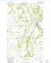
 1982 Stephen East1982 Print · USGSThe Marshall County prairie in the early 1980s is defined by the sharp bends of the Tamarac River and the rural townships of Sinnott and Augsburg. Researchers can trace the layout of Stephen, including St Stephen Cem and the Burlington Northern line.
 - 1982 Map of Nelson Slough
 1982 Nelson Slough1982 Print · USGSMarshall County in the early eighties shows a landscape of engineered drainage and wildlife conservation north of Thief River Falls. Genealogists and local historians can locate the Opdahl Cem, Wikstrom Cem, and the old Townhall near the Soo Line tracks.
 - 1982 Map of Twistal Swamp
 1982 Twistal Swamp1982 Print · USGSThe marshlands of Kittson County are captured here in the early eighties, showing a landscape defined by the drainage of Twistal Swamp. Local researchers can locate community anchors like the Zion Ch and Townhall alongside the winding Tamarac River.
 - 1982 Map of Stephen West
 1982 Stephen West1982 Print · USGSThe fertile plains of Marshall County are captured here in the early eighties, centered on the western edge of Stephen. Local historians can trace the essential water management systems of Judicial Ditch No 29 and the winding Tamarac River along the Burlington Northern rail line.
 - 1982 Map of Newfolden
 1982 Newfolden1982 Print · USGSThe town of Newfolden and the surrounding Marshall County prairie are documented here during the early eighties. Genealogists and local historians can trace family ties at Augustana Cem, Westaker Cem, and the rural Bethlehem Ch.
 - 1982 Map of Karlstad SW
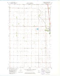
 1982 Karlstad SW1982 Print · USGSKittson County farm country at the dawn of the 1980s reveals a landscape of strictly ordered township grids and drainage canals. Genealogists and local historians can locate the Oslo Cem, find the local Townhall, and trace the boundaries of Spring Brook and Augsburg.2 unique versions available
 - 1982 Map of Argyle
 1982 Argyle1982 Print · USGSArgyle and the surrounding Red River Valley farmland are captured here in the early eighties, showcasing a landscape defined by rail and river. Researchers can locate the St Rose Cem and Woodlawn Cem, or trace the Burlington Northern line through Luna.
 - 1982 Map of Stephen SW
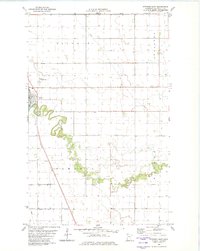
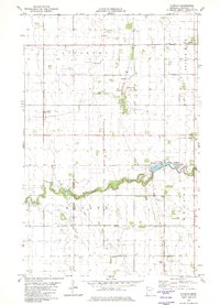
 1982 Stephen SW1982 Print · USGSMarshall County's fertile Red River Valley plains are seen here in the early eighties, defined by a massive drainage network and the winding Middle River. Genealogists and local historians can locate Immanuel Ch, the local Cem, and rural townships like Vega and Tamarac.
 - 1982 Map of Florian
 1982 Florian1982 Print · USGSMarshall County's agricultural and river landscape is captured here in the early eighties, centered on the Tamarac River valley. Genealogists can trace several local burial grounds including Salem Ch Cem and Swedish Cem, or explore the grounds of Florian County Park.
 - 1982 Map of Ellerth
 1982 Ellerth1982 Print · USGSNorthwestern Minnesota's fertile plains are mapped in the early eighties as the river systems of Marsh Grove and Viking were being carefully managed. Trace local family history through landmarks like Ellerth, the Bethania Ch, and Bethesda Cem.
 - 1982 Map of Florian NE
 1982 Florian NE1982 Print · USGSThe rural northwest of Marshall County is shown here in the early eighties, a time of established prairie farming and managed wetlands. Researchers can trace the Tamarac River corridor, locate the Assumption Cem, and find old property structures like the Townhall.
 - 1985 Map of Hallock
 1985 Hallock1985 Print · USGSNorthwestern Minnesota’s borderlands are captured here in the mid-1980s as a managed landscape of agriculture and conservation. Trace the Burlington Northern line through historic rail towns like Hallock or locate remote airstrips and the expansive Lake Bronson State Park.2 unique versions available
 - 1985 Map of Grafton
 1985 Grafton1985 Print · USGSThe Red River Valley at the mid-eighties shows a landscape of deep-rooted agriculture and rail-side towns. Genealogists and historians can trace family land near Grafton, Minto, or Lankin, and locate conservation landmarks like the Ardoch National Wildlife Refuge.2 unique versions available
 - 1985 Map of Thief River Falls
 1985 Thief River Falls1985 Print · USGSNorthwestern Minnesota’s agricultural heartland is captured here in the mid-eighties, showing the transition from drainage-dependent farmlands to vast wildlife refuges. Trace the Burlington Northern rail lines through Warren and Stephen, or locate family landmarks near Dakota Junction and Carpenters Corner.
 - 1985 Map of Cavalier
 1985 Cavalier1985 Print · USGSThe Red River Valley and the international border meet in this mid-1980s look at the drainage and rail networks of Northeast North Dakota. Trace the paths of the Burlington Northern and Soo Line through border towns like Neche, Pembina, and Noyes.2 unique versions available
End of results
Showing maps 1-22 of 22
Top cities of Marshall County
- Warren historical maps
- Stephen historical maps
- Argyle historical maps
- Alvarado historical maps
- Newfolden historical maps
- Oslo historical maps
See more
Frequently asked questions
- What are the different types of historical maps available for Marshall County?
- What is the oldest map of Marshall County?
- Where can I purchase historical maps of Marshall County for my home or office?
- Where can I download high-res historical maps of Marshall County?
- Are there historical topographic maps available for Marshall County?
- Is there historical aerial imagery available for Marshall County?
- Where are historical maps of Marshall County sourced from?