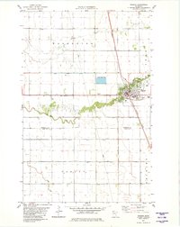
1982 Map of Warren
USGS Topo · Published 1982About this map
Warren serves as the primary hub of this Red River Valley landscape, situated at the crossing of the Burlington Northern and Soo Line railroads. The town’s 1980s layout features a central High Sch, a Cem on its northwestern edge, and recreational spaces including a Golf Course and Campground. The surrounding prairie is defined by a highly organized system of water management, with numerous channels such as Judicial Ditch No 16 and County Ditch No 4 draining the flat agricultural terrain toward the Snake River. This river winds across the townships of Boxville and Warrenton, while smaller features like the Melgard Coulee and a Drive-in Theater west of town mark the cultural and physical geography of Marshall County during this era.
Find a feature on this map
28 named features on this map. Tap any name to fly to it.
Don’t see what you’re looking for? This feature index may not catch every label — zoom into the map to look around manually.
Map Details
Editions of this 1982 Warren Map
This is the sole edition of this map. No revisions or reprints were ever made.
Other maps of this area

1918 · Angus
USGS Topo · 1:62,500

1918 · Argyle
USGS Topo · 1:62,500

1918 · Warren
USGS Topo · 1:62,500

1952 · Thief River Falls
USGS Topo · 1:250,000

1954 · Stephen
USGS Topo · 1:62,500

1955 · Warren
USGS Topo · 1:62,500

1956 · Thief River Falls
USGS Topo · 1:250,000

1956 · Florian
USGS Topo · 1:62,500

1957 · Thief River Falls
USGS Topo · 1:250,000
1961 · Angus
USGS Topo · 1:24,000