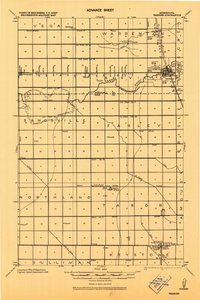
1918 Map of Warren
USGS Topo · Published 1943About this map
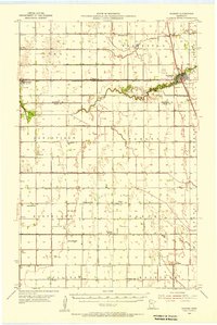
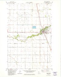
Warren serves as the regional anchor on this 1918 military survey of the Red River Valley, where the Great Northern Div. railroad intersects a landscape defined by an extensive drainage network. The engineering of the Red River North country is visible in the myriad of channels such as State Ditch and Jud. Ditch No. 16, which were essential for reclaiming the flat prairie for agriculture. Local landmarks like the Warren Courthouse Tower and Warren Standpipe denote the town's prominence, while rural infrastructure is captured through features like the Woodward Farm Elevator and several farm crossings.
Find a feature on this map
52 named features on this map. Tap any name to fly to it.
Don’t see what you’re looking for? This feature index may not catch every label — zoom into the map to look around manually.
Map Details
Editions of this 1918 Warren Map
This is the sole edition of this map. No revisions or reprints were ever made.
Historical Maps of Warren Through Time
8 maps found