1950s Maps of Marshall County, Minnesota
Explore 14 historic maps of Marshall County from the 1950s. These maps offer a rare glimpse into what life looked like during the 1950s — showing old roads, neighborhoods, homes, and landmarks that have changed or disappeared over time.
Whether you're researching your family's past, planning a metal detecting trip, or studying how Marshall County's landscape evolved across the 1950s, these high-resolution maps are a powerful tool for exploring the history of this region.
- Focus on a specific era: All maps on this page are from the 1950s, giving you a focused view of this time period.
- See what’s changed: Compare century-old streets, trails, and buildings to today's modern landscape using overlays and satellite layers.
- Research with precision: Use these maps for genealogy, historical research, land use analysis, or educational projects.
- View, download, or print: Maps are fully viewable online in high resolution, and can be downloaded or printed for your own records.
Start exploring Marshall County's history through authentic maps from the 1950s. This is your window into the past.
Marshall County, MN maps
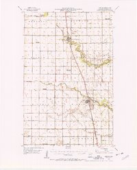
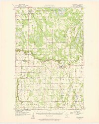
(14)- 1952 Map of Thief River Falls, 1967 Print
 1952 Thief River Falls1967 Print · USGSThe Red River Valley's agricultural and conservation landscape is captured in the mid-1950s, detailing a web of rail lines and international border crossings. Researchers can trace family roots in towns like Thief River Falls, locate the State School for Blind, and survey landmarks like the Agassiz National Wildlife Refuge.2 unique versions available
 - 1954 Map of Stephen, 1955 Print
 1954 Stephen1955 Print · USGSMarshall County's Red River Valley landscape is shown here during a period of rural consolidation in the mid-fifties. Genealogists can trace former country school sites like LaVine Sch and School No 70 or locate the St Stephen Cem.2 unique versions available
 - 1954 Map of Roseau, 1969 Print
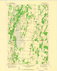
 1954 Roseau1969 Print · USGSNorthern Minnesota's borderlands come alive in the 1950s, showing a landscape defined by timber, water, and rail. Trace family roots through old schools and cemeteries near Roseau, Warroad, and the expansive Red Lake Indian Reservation.2 unique versions available
 - 1955 Map of Warren, 1956 Print
 1955 Warren1956 Print · USGSThe Red River Valley's agricultural heartland is documented here in the mid-fifties, centered on the rail crossroads of Warren. Genealogists can trace rural family roots through an extensive network of schoolhouses like Sandsville Sch and cemeteries such as Nyskoga Cem.
 - 1956 Map of Thief River Falls
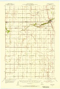
 1956 Thief River Falls1956 Print · USGSThe Red River Valley in the mid-1950s is captured here as a sprawling network of rail corridors and wildlife refuges along the Canadian border. Trace the vanished transport routes of the Dismantled railroad and Abandoned railroad or locate local landmarks like the Herrick Elevator and State School for Blind.
 - 1956 Map of Karlstad, 1958 Print
 1956 Karlstad1958 Print · USGSNorthwestern Minnesota in the mid-fifties is captured here as a grid of grain-country townships connected by the Soo Line. Trace the rural development of the era through sites like Lake Bronson State Park, Bepson Sch, and Hegland Ch.2 unique versions available
 - 1956 Map of Florian, 1958 Print
 1956 Florian1958 Print · USGSMarshall County’s prairie landscape is captured here in the mid-fifties, defined by the winding paths of the Tamarac River and Middle River. Genealogists can trace early rural life through numerous sites like Alma Ch, Englund, and Woodland Sch.
 - 1957 Map of Roseau
 1957 Roseau1957 Print · USGSThe international border and tribal lands define Northern Minnesota in the mid-fifties, from the shores of Lake of the Woods to the Red Lake Indian Reservation. Researchers can trace the path of the Great Northern railroad and locate isolated outposts like the U S Custom House and Ponemah.
 - 1957 Map of Thief River Falls
 1957 Thief River Falls1957 Print · USGSThe Red River Valley in the mid-fifties is captured here as a thriving network of rail towns and conservation lands. Genealogists and historians can trace family roots through settlements like Grafton, Pembina, and Hallock, or locate landmarks such as the State School for Blind and the Great Northern RR corridor.
 - 1957 Map of Newfolden, 1958 Print
 1957 Newfolden1958 Print · USGSThe grain-growing plains of Marshall County come alive in the late fifties, centered on the railroad towns of Newfolden and Strandquist. Genealogists can trace family roots through numerous local landmarks, including Mamrelund Ch, Oak Grove Cem, and Edgewood Sch.2 unique versions available
 - 1957 Map of Pelan, 1959 Print
 1957 Pelan1959 Print · USGSNorthwestern Minnesota in the late fifties was a landscape of township grids and river branches. Genealogists and historians can trace local landmarks like Zion Ch, the rail line of the Minneapolis St Paul and Sault Ste Marie, and the settlement of Pelan.
 - 1958 Map of Roseau
 1958 Roseau1958 Print · USGSNorthern Minnesota's borderlands and vast lake country are captured here in the late fifties. Researchers can trace the Canadian National rail line through Warroad or find family history in frontier settlements like Baudette, Waskish, and Shotley.
 - 1959 Map of Viking, 1960 Print
 1959 Viking1960 Print · USGSNorthwestern Minnesota's prairie and river land is captured here in the late fifties as the regional rail economy remained vital. Genealogists and local historians can trace family land near Viking, Carpenters Corner, and the Roosevelt Sch.2 unique versions available
 - 1959 Map of Rosewood, 1960 Print
 1959 Rosewood1960 Print · USGSThe Marshall and Pennington County line in the late fifties shows a rural landscape anchored by the Soo Line railroad. Genealogy researchers can locate family sites at Wildwood Cem, Hegland Cem, and Rindal Ch.2 unique versions available
End of results
Showing maps 1-14 of 14
Top cities of Marshall County
- Warren historical maps
- Stephen historical maps
- Argyle historical maps
- Alvarado historical maps
- Newfolden historical maps
- Oslo historical maps
See more
Frequently asked questions
- What are the different types of historical maps available for Marshall County?
- What is the oldest map of Marshall County?
- Where can I purchase historical maps of Marshall County for my home or office?
- Where can I download high-res historical maps of Marshall County?
- Are there historical topographic maps available for Marshall County?
- Is there historical aerial imagery available for Marshall County?
- Where are historical maps of Marshall County sourced from?