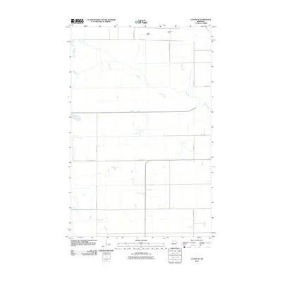
2010 Map of Gatzke SE
USGS Topo · Published 2010About this map
Mud River and Lost River define the drainage of this portion of Marshall County, winding through a landscape organized by a precise grid of rural roads and section lines. The terrain is notably flat, characterized by agricultural use and sparsely distributed landmarks like Arthur Field and Klamar Field in the north. The map traces the rectilinear development of the modern township system, where routes such as County Hwy-7 and 340th St NE provide the primary infrastructure for the farming community. A subtle marker for Agassiz indicates the regional connection to the prehistoric glacial lake bed that shaped this fertile but level plain. This 2010 survey by the U.S. Geological Survey records the persistent rural character of the region, where the intersection of watercourses and section roads remains the primary geographic framework.
Find a feature on this map
14 named features on this map. Tap any name to fly to it.
Don’t see what you’re looking for? This feature index may not catch every label — zoom into the map to look around manually.
Map Details
Editions of this 2010 Gatzke SE Map
This is the sole edition of this map. No revisions or reprints were ever made.
Other maps of this area

1918 · Rollis
USGS Topo · 1:62,500

1919 · Liner
USGS Topo · 1:62,500

1943 · Rollis
USGS Topo · 1:62,500

1954 · Roseau
USGS Topo · 1:250,000

1957 · Roseau
USGS Topo · 1:250,000

1958 · Roseau
USGS Topo · 1:250,000
1962 · Gatzke NW
USGS Topo · 1:24,000

1962 · Gatzke SE
USGS Topo · 1:24,000
1962 · Gatzke SW
USGS Topo · 1:24,000

1962 · Gatzke
USGS Topo · 1:24,000