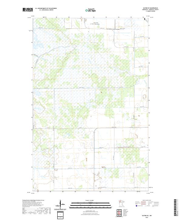
2022 Map of Gatzke SE
USGS Topo · Published 2022About this map
The Mud River and Lost River meander through a vast wetland landscape in Marshall County, defined by a rigid grid of section lines and gravel roads. This 2022 survey captures a remote portion of northern Minnesota where drainage and conservation efforts have shaped the modern geography. Significant corridors like Co Hwy 7 and Refuge Rd provide access to the interior, while Consolidated Conservation Trails Trl suggests the area's role in land management.
Find a feature on this map
32 named features on this map. Tap any name to fly to it.
Don’t see what you’re looking for? This feature index may not catch every label — zoom into the map to look around manually.
Map Details
Editions of this 2022 Gatzke SE Map
This is the sole edition of this map. No revisions or reprints were ever made.
Other maps of this area

1918 · Rollis
USGS Topo · 1:62,500

1919 · Liner
USGS Topo · 1:62,500

1943 · Rollis
USGS Topo · 1:62,500

1954 · Roseau
USGS Topo · 1:250,000

1957 · Roseau
USGS Topo · 1:250,000

1958 · Roseau
USGS Topo · 1:250,000
1962 · Gatzke NW
USGS Topo · 1:24,000

1962 · Gatzke SE
USGS Topo · 1:24,000
1962 · Gatzke SW
USGS Topo · 1:24,000

1962 · Gatzke
USGS Topo · 1:24,000