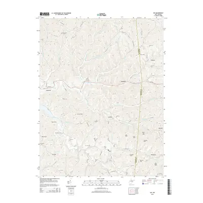
2014 Map of Gay
USGS Topo · Published 2014About this map
Harmon Ridge and Zion Ridge dominate the landscape of this rural West Virginia region, where the border between Jackson and Roane Counties winds through a complex network of stream valleys. Small communities like Gay, Hereford, and Frozencamp are scattered along the winding paths of Little Mill Creek and Frozencamp Creek. The map reveals a dense concentration of small family and community cemeteries, including Harpold Cem, Parsons Cem, and the Baptist Grove Cem, reflecting the deep-rooted genealogical history of these hollows.
Find a feature on this map
111 named features on this map. Tap any name to fly to it.
Don’t see what you’re looking for? This feature index may not catch every label — zoom into the map to look around manually.
Map Details
Editions of this 2014 Gay Map
This is the sole edition of this map. No revisions or reprints were ever made.
Other maps of this area

1906 · Kenna
USGS Topo · 1:62,500

1906 · Walton
USGS Topo · 1:62,500

1907 · Kenna
USGS Topo · 1:62,500

1907 · Spencer
USGS Topo · 1:62,500

1907 · Walton
USGS Topo · 1:62,500

1907 · Ripley
USGS Topo · 1:62,500

1926 · Ripley
USGS Topo · 1:62,500

1928 · Spencer
USGS Topo · 1:62,500

1928 · Ripley
USGS Topo · 1:62,500

1954 · Charleston
USGS Topo · 1:250,000