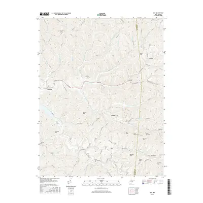
2016 Map of Gay
USGS Topo · Published 2016About this map
Mount Hope Church of God stands in the northern uplands of this West Virginia landscape, highlighting a region defined by scattered rural communities and complex ridgeline topography. The map details a network of family-named cemeteries such as Waybright Cem, Litton Cem, and Parsons Cem, which provide essential clues for genealogical research in Roane and Jackson counties. Small settlements like Gay, Hereford, and Marshall are linked by winding routes like Spencer Rd and Gay Allentown Rd. The terrain is deeply dissected by a dense drainage system, including Little Mill Creek, Frozencamp Creek, and Spruce Run, creating distinct ridges such as Harmon Ridge and Zion Ridge. The transition from the high points at McCracken Knob to the hollows like Baby Hollow illustrates the traditional Appalachian settlement pattern where homes and roads follow the narrow valley floors and accessible gaps.
Find a feature on this map
111 named features on this map. Tap any name to fly to it.
Don’t see what you’re looking for? This feature index may not catch every label — zoom into the map to look around manually.
Map Details
Editions of this 2016 Gay Map
This is the sole edition of this map. No revisions or reprints were ever made.
Other maps of this area

1906 · Kenna
USGS Topo · 1:62,500

1906 · Walton
USGS Topo · 1:62,500

1907 · Kenna
USGS Topo · 1:62,500

1907 · Spencer
USGS Topo · 1:62,500

1907 · Walton
USGS Topo · 1:62,500

1907 · Ripley
USGS Topo · 1:62,500

1926 · Ripley
USGS Topo · 1:62,500

1928 · Spencer
USGS Topo · 1:62,500

1928 · Ripley
USGS Topo · 1:62,500

1954 · Charleston
USGS Topo · 1:250,000