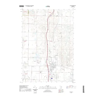
2019 Map of Gaylord
USGS Topo · Published 2019About this map
The northern Michigan landscape around Gaylord is defined by its glacial lakes and the headwaters of the Sturgeon River. This 2019 survey captures the city's role as a regional hub, featuring the Gaylord Regional Airport and the centrally located Otsego County Building. The topography is dotted with numerous small bodies of water, including Five Lakes, Berry Lake, and Otung Lake, which illustrate the area's characteristic post-glacial hydrology. For those tracing local history or family lineage, the map identifies several significant burial grounds, such as Fairview Cem, Bagley Cem, and Saint Marys Cem. The development pattern follows a grid of township roads like W Winters Rd and Parmater Rd, showing how the modern streetscape in this portion of the Lower Peninsula has matured around its historical lakeside settlements and natural drainage ways.
Find a feature on this map
62 named features on this map. Tap any name to fly to it.
Don’t see what you’re looking for? This feature index may not catch every label — zoom into the map to look around manually.
Map Details
Editions of this 2019 Gaylord Map
This is the sole edition of this map. No revisions or reprints were ever made.
Other maps of this area

1949 · Otsego Lake
USGS Topo · 1:62,500

1950 · Turtle Lake
USGS Topo · 1:24,000

1951 · Turtle Lake
USGS Topo · 1:24,000

1951 · Otsego Lake
USGS Topo · 1:24,000

1954 · Gaylord
USGS Topo · 1:62,500

1954 · Traverse City
USGS Topo · 1:250,000

1955 · Cheboygan
USGS Topo · 1:250,000

1956 · Alba
USGS Topo · 1:62,500

1958 · Cheboygan
USGS Topo · 1:250,000

1958 · Traverse City
USGS Topo · 1:250,000