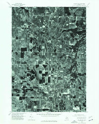
1975 Map of Gaylord SW
USGS Topo · Published 1976About this map
Gaylord anchor the southeastern corner of this orthophotograph, showing the town's expanding residential grid and industrial footprints as they appeared in the mid-1970s. This specific type of survey combines the detail of an aerial photograph with the geometric accuracy of a topographic map, revealing the exact textures of the Michigan landscape. Beyond the concentrated development of Gaylord, the map shows a patchwork of managed woodlots and rectangular agricultural clearings, characteristic of the northern Lower Peninsula. A major north-south transportation corridor bisects the terrain, illustrating how modern infrastructure began to reorganize the rural space around the county seat during this era of growth.
Find a feature on this map
1 named feature on this map. Tap any name to fly to it.
Don’t see what you’re looking for? This feature index may not catch every label — zoom into the map to look around manually.
Map Details
Editions of this 1975 Gaylord SW Map
This is the sole edition of this map. No revisions or reprints were ever made.
Other maps of this area

1949 · Otsego Lake
USGS Topo · 1:62,500

1950 · Turtle Lake
USGS Topo · 1:24,000

1951 · Turtle Lake
USGS Topo · 1:24,000

1951 · Otsego Lake
USGS Topo · 1:24,000

1954 · Gaylord
USGS Topo · 1:62,500

1954 · Traverse City
USGS Topo · 1:250,000

1955 · Cheboygan
USGS Topo · 1:250,000

1956 · Alba
USGS Topo · 1:62,500

1958 · Cheboygan
USGS Topo · 1:250,000

1958 · Traverse City
USGS Topo · 1:250,000