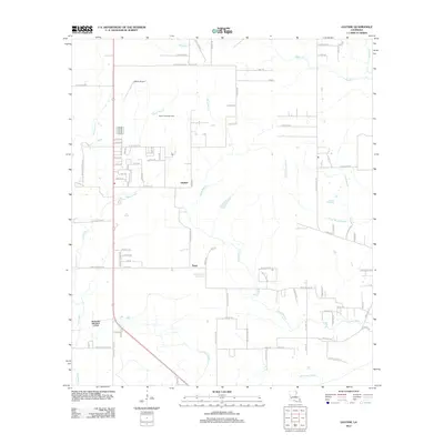
2012 Map of Gaytine
USGS Topo · Published 2012About this map
Gaytine and Turps serve as the primary settlement points in this Louisiana landscape, which is defined by an intricate network of waterways and oil infrastructure. The South Fulton Oil Field indicates the industrial importance of the region, while Habetz Airport provides a localized aviation hub. The drainage pattern is complex, featuring the Hickory Branch Canal alongside numerous bayous such as Indian Bayou, Little Indian Bayou, and Marsh Bayou. Local transit and land use are further marked by named crossings like Bushnell Frd and family-named routes such as Gene Stanley and Newt Hodges Rd, reflecting the rural and extractive character of the area in the early 21st century.
Find a feature on this map
96 named features on this map. Tap any name to fly to it.
Don’t see what you’re looking for? This feature index may not catch every label — zoom into the map to look around manually.
Map Details
Editions of this 2012 Gaytine Map
This is the sole edition of this map. No revisions or reprints were ever made.
Other maps of this area

1935 · Buhler
USGS Topo · 1:31,680

1935 · Moss Bluff
USGS Topo · 1:31,680

1935 · Gordon
USGS Topo · 1:31,680

1935 · Gaytine
USGS Topo · 1:31,680

1935 · Longville
USGS Topo · 1:31,680

1947 · Gaytine
USGS Topo · 1:31,680

1947 · Moss Bluff
USGS Topo · 1:31,680

1947 · Hecker
USGS Topo · 1:31,680

1947 · Kernan
USGS Topo · 1:31,680

1947 · Reeves
USGS Topo · 1:31,680