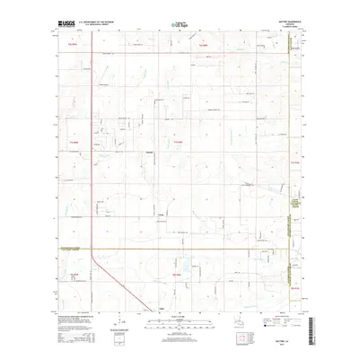
2015 Map of Gaytine
USGS Topo · Published 2015About this map
Marsh Bayou and Indian Bayou dominate the drainage patterns of this Southwest Louisiana landscape, where the borders of Beauregard, Calcasieu, Jefferson Davis, and Allen Parishes meet. The settlement at Gaytine serves as a central point along Gaytine Rd, while the small community of Turps sits further south. The terrain is characterized by a dense network of local roads named for established families, such as Edna Guillery Rd, Dave Cole Rd, and Bennie Felice Rd, suggesting a long history of local land ownership and rural development. Private aviation is represented by Habetz Airport north of the main settlement. The lower portion of the area features Little Indian Bayou and Blackman Bayou as they wind through the flats toward Gillis, illustrating the complex water systems common to the coastal plain region.
Find a feature on this map
92 named features on this map. Tap any name to fly to it.
Don’t see what you’re looking for? This feature index may not catch every label — zoom into the map to look around manually.
Map Details
Editions of this 2015 Gaytine Map
This is the sole edition of this map. No revisions or reprints were ever made.
Other maps of this area

1935 · Buhler
USGS Topo · 1:31,680

1935 · Moss Bluff
USGS Topo · 1:31,680

1935 · Gordon
USGS Topo · 1:31,680

1935 · Gaytine
USGS Topo · 1:31,680

1935 · Longville
USGS Topo · 1:31,680

1947 · Gaytine
USGS Topo · 1:31,680

1947 · Moss Bluff
USGS Topo · 1:31,680

1947 · Hecker
USGS Topo · 1:31,680

1947 · Kernan
USGS Topo · 1:31,680

1947 · Reeves
USGS Topo · 1:31,680