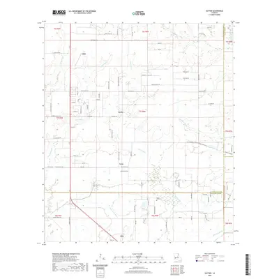
2020 Map of Gaytine
USGS Topo · Published 2020About this map
Gaytine and Turps are central nodes in this rural parish landscape, where the flat coastal plains of Southwest Louisiana are intricately dissected by a network of bayous and gullies. The confluence of Indian Bayou and Jackson Gully in the northwest, along with the meandering Marsh Bayou through the center, suggests a landscape defined by its drainage and seasonal water levels. These waterways dictated the placement of early settlements and the subsequent road network that connects scattered homesteads and agricultural tracts. Notable local landmarks such as Habetz Airport and the Reeves Garden Cem provide points of interest for those tracing family history in the area near the northern border of Gillis. The map also captures the jurisdictional boundaries where Beauregard Parish meets Calcasieu Parish and Jefferson Davis Parish, illustrating how these administrative lines follow the natural landscape or the surveyed section lines of the Public Land Survey System.
Find a feature on this map
54 named features on this map. Tap any name to fly to it.
Don’t see what you’re looking for? This feature index may not catch every label — zoom into the map to look around manually.
Map Details
Editions of this 2020 Gaytine Map
This is the sole edition of this map. No revisions or reprints were ever made.
Other maps of this area

1935 · Buhler
USGS Topo · 1:31,680

1935 · Moss Bluff
USGS Topo · 1:31,680

1935 · Gordon
USGS Topo · 1:31,680

1935 · Gaytine
USGS Topo · 1:31,680

1935 · Longville
USGS Topo · 1:31,680

1947 · Gaytine
USGS Topo · 1:31,680

1947 · Moss Bluff
USGS Topo · 1:31,680

1947 · Hecker
USGS Topo · 1:31,680

1947 · Kernan
USGS Topo · 1:31,680

1947 · Reeves
USGS Topo · 1:31,680