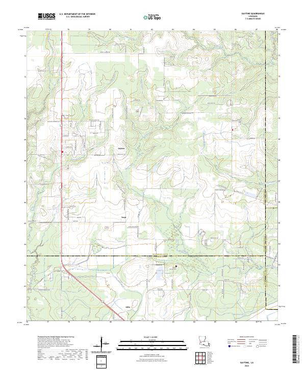
2024 Map of Gaytine
USGS Topo · Published 2024About this map
The low-lying piney woods of southwest Louisiana are defined by a complex drainage network where Marsh Bayou and Indian Bayou converge. This landscape, situated at the tri-parish border of Beauregard, Jefferson Davis, and Calcasieu parishes, centers on the small settlements of Gaytine and Turps. To the south, the community of Gillis sits near the headwaters of Little Indian Bayou, illustrating the historical reliance on these waterways for early transport and drainage.
Find a feature on this map
110 named features on this map. Tap any name to fly to it.
Don’t see what you’re looking for? This feature index may not catch every label — zoom into the map to look around manually.
Map Details
Editions of this 2024 Gaytine Map
This is the sole edition of this map. No revisions or reprints were ever made.
Other maps of this area

1935 · Buhler
USGS Topo · 1:31,680

1935 · Moss Bluff
USGS Topo · 1:31,680

1935 · Gordon
USGS Topo · 1:31,680

1935 · Gaytine
USGS Topo · 1:31,680

1935 · Longville
USGS Topo · 1:31,680

1947 · Gaytine
USGS Topo · 1:31,680

1947 · Moss Bluff
USGS Topo · 1:31,680

1947 · Hecker
USGS Topo · 1:31,680

1947 · Kernan
USGS Topo · 1:31,680

1947 · Reeves
USGS Topo · 1:31,680