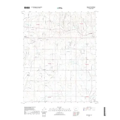
2019 Map of Gem Village
USGS Topo · Published 2019About this map
Gem Village and the high desert plateaus of La Plata County are defined by a sophisticated network of historical irrigation infrastructure. This modern survey illustrates how water management has shaped settlement patterns, with the King Consolidated Ditch and Morrison Consolidated Ditch carving paths through the terrain to support local life. Between the Florida River and the Los Pinos River, the landscape is marked by deep geographic features like Brice Canyon and Holman Canyon. Genealogists and local historians can locate the Ouray Memorial Cem in the southeastern corner near the riverbanks, while the presence of the Durango-La Plata County Airport near Oxford signals the area's role as a regional transit hub. Smaller settlements like Florida and numerous family-named roads further reveal the distributed nature of this Colorado community.
Find a feature on this map
111 named features on this map. Tap any name to fly to it.
Don’t see what you’re looking for? This feature index may not catch every label — zoom into the map to look around manually.
Map Details
Editions of this 2019 Gem Village Map
This is the sole edition of this map. No revisions or reprints were ever made.
Other maps of this area

1898 · Durango
USGS Topo · 1:62,500

1907 · Durango
USGS Topo · 1:62,500

1908 · Ignacio
USGS Topo · 1:125,000

1908 · Durango
USGS Topo · 1:62,500

1924 · Ignacio
USGS Topo · 1:125,000

1945 · Durango
USGS Topo · 1:250,000

1953 · Durango
USGS Topo · 1:250,000

1954 · Durango
USGS Topo · 1:250,000

1961 · Durango
USGS Topo · 1:250,000

1963 · Durango
USGS Topo · 1:250,000