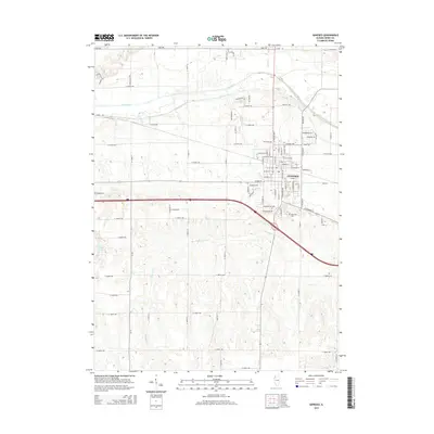
2015 Map of Geneseo
USGS Topo · Published 2015About this map
Geneseo serves as the focal point of this Henry County landscape, where the street grid of the city meets the sprawling agricultural sections of northwestern Illinois. The terrain is defined by the winding course of the Green River to the north and the meandering Geneseo Cr which cuts through the southern half of the quadrangle. Local history is anchored by several burial grounds, including the centrally located Oakwood Cem and North Cem, as well as the more isolated Edford Cem to the west. The area's transition from river bottomlands to higher ground is marked by features like Hickory Hts and Roos Hill Rd. Small water bodies such as Swint Lake and Elks Br provide additional detail to a landscape primarily organized by a rigid grid of rural roads like Stagecoach Rd and Canal Rd.
Find a feature on this map
82 named features on this map. Tap any name to fly to it.
Don’t see what you’re looking for? This feature index may not catch every label — zoom into the map to look around manually.
Map Details
Editions of this 2015 Geneseo Map
This is the sole edition of this map. No revisions or reprints were ever made.
Other maps of this area

1892 · Leclaire
USGS Topo · 1:62,500

1893 · Leclaire
USGS Topo · 1:62,500

1899 · Clinton
USGS Topo · 1:125,000

1934 · Geneseo
USGS Topo · 1:62,500

1937 · Orion
USGS Topo · 1:62,500

1949 · Port Byron
USGS Topo · 1:24,000

1950 · Port Byron
USGS Topo · 1:24,000

1952 · Erie
USGS Topo · 1:62,500
1953 · Port Byron
USGS Topo · 1:24,000

1953 · German Corner
USGS Topo · 1:24,000