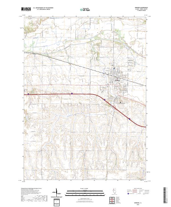
2024 Map of Geneseo
USGS Topo · Published 2024About this map
Geneseo serves as the primary hub of this Henry County landscape, where the street grid expands into a series of residential drives like Gooseberry Dr and Mulberry Dr near the city's northern edge. The surrounding terrain is defined by the winding course of the Green River, which is joined by tributaries including Elks Branch and Geneseo Creek. This 2024 U.S. Geological Survey update captures the modern infrastructure of the region, showing the persistent importance of early routes such as Stagecoach Rd and Canal Rd alongside contemporary developments. For those researching local history or genealogy, the map provides clear locations for Oakwood Cem on the town's eastern side and Edford Cem further west, resting near the rolling drainage of Swint Lake and Oak Creek.
Find a feature on this map
89 named features on this map. Tap any name to fly to it.
Don’t see what you’re looking for? This feature index may not catch every label — zoom into the map to look around manually.
Map Details
Editions of this 2024 Geneseo Map
This is the sole edition of this map. No revisions or reprints were ever made.
Other maps of this area

1892 · Leclaire
USGS Topo · 1:62,500

1893 · Leclaire
USGS Topo · 1:62,500

1899 · Clinton
USGS Topo · 1:125,000

1934 · Geneseo
USGS Topo · 1:62,500

1937 · Orion
USGS Topo · 1:62,500

1949 · Port Byron
USGS Topo · 1:24,000

1950 · Port Byron
USGS Topo · 1:24,000

1952 · Erie
USGS Topo · 1:62,500
1953 · Port Byron
USGS Topo · 1:24,000

1953 · German Corner
USGS Topo · 1:24,000