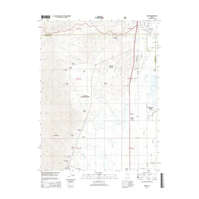
2014 Map of Genoa
USGS Topo · Published 2014About this map
The Carson River and its intricate drainage system, including Williams Slough and Heyburn Ditch, define the transition from the valley floor to the Sierra Nevada foothills. In the early 21st century, the western portion of this area remains largely protected within the Toiyabe National Forest, where steep canyons such as Genoa Canyon and Sierra Canyon descent toward the historic settlement of Genoa. The eastern half of the map shows significant residential and infrastructure development, including Indian Hills and Johnson Lane, anchored by the Minden-Tahoe Airport. For those researching local heritage, the landscape is dotted with several burial sites, such as Jacks Valley Cemetery and the Chedic Cemetery, which sit near the northern boundary line separating Douglas and Carson City counties.
Find a feature on this map
78 named features on this map. Tap any name to fly to it.
Don’t see what you’re looking for? This feature index may not catch every label — zoom into the map to look around manually.
Map Details
Editions of this 2014 Genoa Map
This is the sole edition of this map. No revisions or reprints were ever made.
Other maps of this area

1889 · Markleeville
USGS Topo · 1:125,000

1891 · Carson
USGS Topo · 1:125,000

1891 · Markleeville
USGS Topo · 1:125,000

1893 · Carson
USGS Topo · 1:125,000

1893 · Markleeville
USGS Topo · 1:125,000

1948 · Walker Lake
USGS Topo · 1:250,000

1955 · Bijou
USGS Topo · 1:24,000

1955 · Marlette Lake
USGS Topo · 1:24,000

1955 · Glenbrook
USGS Topo · 1:24,000

1956 · Freel Peak
USGS Topo · 1:62,500