2021 Map of Genoa
USGS Topo · Published 2021About this map
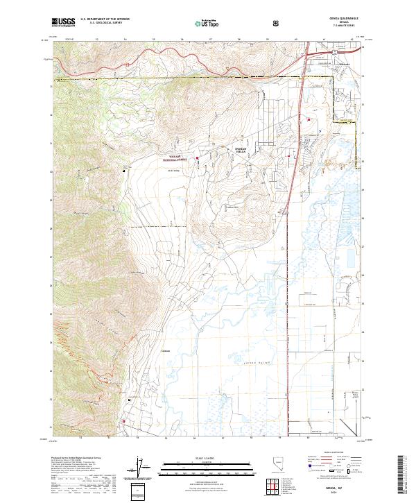
Genoa and the western edge of the Carson Valley are the focus of this recent survey, where the steep canyons of the Toiyabe National Forest meet the valley floor. The map highlights the transition from the rugged drainage of Adams Canyon and Sierra Canyon to the irrigated agricultural lands and expanding residential developments of Indian Hills. For family historians, the presence of the Genoa Cem and Jacks Valley Cem provides specific points of interest within these historic settlements. The hydrology of the area is well-defined, featuring natural thermal features like Hobo Hot Springs and Sulphur Springs, alongside man-made water management systems such as the Heyburn Ditch. Modern infrastructure is represented by the Minden-Tahoe Airport at the southeastern corner and the suburban street networks branching off Haystack Dr and Sunridge Dr.
Find a feature on this map
68 named features on this map. Tap any name to fly to it.
Don’t see what you’re looking for? This feature index may not catch every label — zoom into the map to look around manually.
Map Details
Editions of this 2021 Genoa Map
This is the sole edition of this map. No revisions or reprints were ever made.