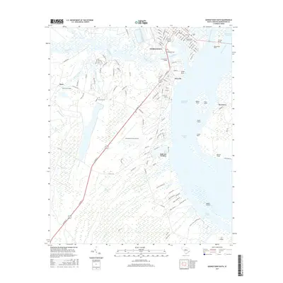
2017 Map of Georgetown South
USGS Topo · Published 2017About this map
Georgetown and its surrounding coastal lowlands are defined by a complex network of waterways where the Sampit River, Waccamaw River, and Great Pee Dee River converge into Winyah Bay. This 2017 study illustrates the intersection of deep-rooted local history and modern infrastructure, featuring the historic Prince George Winyah Cem and Jewish Cem near the downtown grid. The landscape transitions from the urban density of Maryville to the sprawling wetlands of White Oak Bay and Flat Bay. Significant coastal features include the Intracoastal Waterway and the Georgetown County Airport, which occupy the high ground between the marshes. Genealogists will find interest in the scattered burial grounds like Pennyroyal Cem, while the positioning of Belle Isle Gardens reflects the area's long-standing relationship with the South Carolina coast's tidal topography.
Find a feature on this map
135 named features on this map. Tap any name to fly to it.
Don’t see what you’re looking for? This feature index may not catch every label — zoom into the map to look around manually.
Map Details
Editions of this 2017 Georgetown South Map
This is the sole edition of this map. No revisions or reprints were ever made.
Other maps of this area

1942 · Santee Point
USGS Topo · 1:24,000

1942 · North Island
USGS Topo · 1:24,000

1942 · Waverly Mills
USGS Topo · 1:24,000

1943 · Olin
USGS Topo · 1:31,680

1943 · Kilsock Bay
USGS Topo · 1:24,000

1943 · Santee
USGS Topo · 1:24,000

1943 · Georgetown North
USGS Topo · 1:24,000

1943 · Minim Island
USGS Topo · 1:24,000

1943 · Georgetown South
USGS Topo · 1:24,000

1947 · Georgetown South
USGS Topo · 1:24,000
Featured Places
- Georgetown, SC
- Steele Town, Georgetown
- White Hall Estates, SC
- Belle Isle Estates, SC
- Belle Isle Gardens, SC