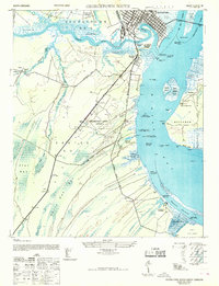
1968 Map of Georgetown South
USGS Topo · Published 1968About this map
Georgetown sits at the confluence of the Sampit River and the Winyah Bay, serving as a focal point for a landscape defined by its historic rice culture and coastal infrastructure. The map documents numerous Abandoned Rice Fields along the riverbanks, illustrating the transition of the South Carolina Lowcountry from its plantation-era economy toward a mid-century military and industrial posture. Notable landmarks like the Georgetown Naval Airport (Under Construction) and the Sampit River Bridge indicate significant development during the 1940s.
Find a feature on this map
56 named features on this map. Tap any name to fly to it.
Don’t see what you’re looking for? This feature index may not catch every label — zoom into the map to look around manually.
Map Details
Editions of this 1968 Georgetown South Map
This is the sole edition of this map. No revisions or reprints were ever made.
Other maps of this area

1942 · Santee Point
USGS Topo · 1:24,000

1942 · North Island
USGS Topo · 1:24,000

1942 · Waverly Mills
USGS Topo · 1:24,000

1943 · Olin
USGS Topo · 1:31,680

1943 · Kilsock Bay
USGS Topo · 1:24,000

1943 · Santee
USGS Topo · 1:24,000

1943 · Georgetown North
USGS Topo · 1:24,000

1943 · Minim Island
USGS Topo · 1:24,000

1943 · Georgetown South
USGS Topo · 1:24,000

1947 · Georgetown South
USGS Topo · 1:24,000