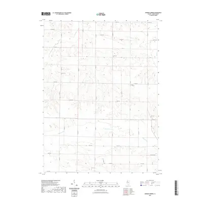
2021 Map of German Corner
USGS Topo · Published 2021About this map
The Edwards River meanders across the southern portion of this Henry County landscape, carving a low-lying valley through a region defined by its agricultural grid. This modern topographic study reveals a rural settlement pattern where family and community heritage is preserved in scattered sites such as Liberty Cem, Greenlee Cem, and Mount Zion Cem. The road network follows the section lines typical of the Midwest, though whimsical local names like Possum Trot Rd offer a glimpse into the local character of the terrain. To the north, drainage is captured by Spring Cr and Mud Cr, highlighting the subtle watershed divisions that dictate the local topography. This map serves as a precise record of the current rural infrastructure, from the county highways to the small cemeteries that ground the area's genealogical history.
Find a feature on this map
32 named features on this map. Tap any name to fly to it.
Don’t see what you’re looking for? This feature index may not catch every label — zoom into the map to look around manually.
Map Details
Editions of this 2021 German Corner Map
This is the sole edition of this map. No revisions or reprints were ever made.
Other maps of this area

1929 · Annawan
USGS Topo · 1:62,500

1931 · Galva
USGS Topo · 1:48,000

1932 · Annawan
USGS Topo · 1:62,500

1934 · Geneseo
USGS Topo · 1:62,500

1940 · Galva
USGS Topo · 1:62,500

1944 · Galva
USGS Topo · 1:62,500

1944 · Kewanee
USGS Topo · 1:62,500

1953 · Nekoma
USGS Topo · 1:24,000

1953 · German Corner
USGS Topo · 1:24,000
1953 · Geneseo
USGS Topo · 1:24,000