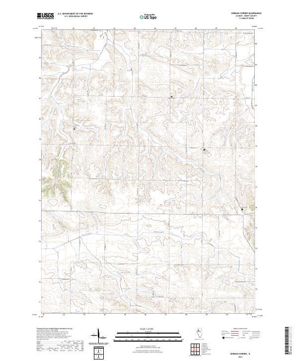
2024 Map of German Corner
USGS Topo · Published 2024About this map
The Edwards River meanders across this rural Henry County landscape, carving a wide valley through the agricultural tablelands of Illinois. Small, family-named burial sites serve as silent markers of the region's pioneering past, including Liberty Cem and Greenlee Cem located along the township road grid. The terrain is further defined by the drainage systems of Spring Creek in the west and Mud Creek in the northeast, which create distinct topographic breaks in the otherwise steady pattern of section lines.
Find a feature on this map
33 named features on this map. Tap any name to fly to it.
Don’t see what you’re looking for? This feature index may not catch every label — zoom into the map to look around manually.
Map Details
Editions of this 2024 German Corner Map
This is the sole edition of this map. No revisions or reprints were ever made.
Other maps of this area

1929 · Annawan
USGS Topo · 1:62,500

1931 · Galva
USGS Topo · 1:48,000

1932 · Annawan
USGS Topo · 1:62,500

1934 · Geneseo
USGS Topo · 1:62,500

1940 · Galva
USGS Topo · 1:62,500

1944 · Galva
USGS Topo · 1:62,500

1944 · Kewanee
USGS Topo · 1:62,500

1953 · Nekoma
USGS Topo · 1:24,000

1953 · German Corner
USGS Topo · 1:24,000
1953 · Geneseo
USGS Topo · 1:24,000