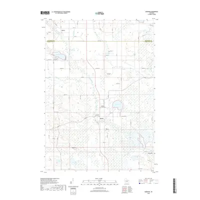
2018 Map of Germania
USGS Topo · Published 2018About this map
The Mecan River and its various tributaries define the landscape of this Central Wisconsin region, which straddles the border of Waushara Co and Marquette Co. Small settlements like Dakota, Budsin, and Germania anchor a rural landscape heavily characterized by wetlands and kettle lakes. The mapping reflects a strong Lutheran heritage, evident in the distribution of community religious sites such as Saint Paul Lutheran Cem near Crystal Lake and Saint Johns Lutheran Cem in Budsin. Distinctive glacial topography is highlighted by named elevations like Mt Pisgah and Stone Hill, which rise above the surrounding lake-studded plains. This 2018 survey captures the intricate drainage patterns of Chaffee Cr and Lunch Cr alongside larger bodies of water like Tuttle Lake and Comstock Lake, providing a clear view of the region's hydrography and historical property divisions.
Find a feature on this map
52 named features on this map. Tap any name to fly to it.
Don’t see what you’re looking for? This feature index may not catch every label — zoom into the map to look around manually.
Map Details
Editions of this 2018 Germania Map
This is the sole edition of this map. No revisions or reprints were ever made.
Other maps of this area

1915 · Neshkoro
USGS Topo · 1:48,000

1918 · Neshkoro
USGS Topo · 1:62,500

1955 · Green Bay
USGS Topo · 1:250,000

1957 · Madison
USGS Topo · 1:250,000

1959 · Wautoma
USGS Topo · 1:48,000

1960 · Madison
USGS Topo · 1:250,000

1961 · Redgranite
USGS Topo · 1:62,500

1961 · Montello
USGS Topo · 1:62,500

1961 · Spring Lake
USGS Topo · 1:24,000

1963 · Neshkoro
USGS Topo · 1:62,500