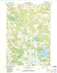
1984 Map of Germania
USGS Topo · Published 1984About this map
The Mecan River and Pine River systems converge in this central Wisconsin landscape, defining a region where water management and conservation are central to the terrain. The expansive Germania Marsh State Wildlife Area dominates the southeastern quadrant, illustrating the transition from agricultural land to protected wetlands. Small, established communities like Germania and Budsin serve as local anchors, while the presence of the United Brethren Ch and several burial sites, including St Johns Ch Cem and the Matz-Tagatz Cem, provide specific points of interest for genealogists tracing family roots in Marquette and Waushara Counties.
Find a feature on this map
51 named features on this map. Tap any name to fly to it.
Don’t see what you’re looking for? This feature index may not catch every label — zoom into the map to look around manually.
Map Details
Editions of this 1984 Germania Map
This is the sole edition of this map. No revisions or reprints were ever made.
Other maps of this area

1915 · Neshkoro
USGS Topo · 1:48,000

1918 · Neshkoro
USGS Topo · 1:62,500

1955 · Green Bay
USGS Topo · 1:250,000

1957 · Madison
USGS Topo · 1:250,000

1959 · Wautoma
USGS Topo · 1:48,000

1960 · Madison
USGS Topo · 1:250,000

1961 · Redgranite
USGS Topo · 1:62,500

1961 · Montello
USGS Topo · 1:62,500

1961 · Spring Lake
USGS Topo · 1:24,000

1963 · Neshkoro
USGS Topo · 1:62,500