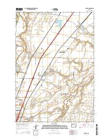
2014 Map of Gervais
USGS Topo · Published 2014About this map
French Prairie and the fertile lands of Howell Prairie define this agricultural corridor north of Salem. The landscape is shaped by the complex drainage of the Little Pudding River and the former lakebed of Lake Labish, now crisscrossed by the Lake Labish Ditch and Jones Ditch. The survey captures the established settlements of Gervais and Brooks alongside the expanding northern reaches of Keizer, where the Salem Keizer Volcanoes Stadium stands as a modern landmark.
Find a feature on this map
113 named features on this map. Tap any name to fly to it.
Don’t see what you’re looking for? This feature index may not catch every label — zoom into the map to look around manually.
Map Details
Editions of this 2014 Gervais Map
This is the sole edition of this map. No revisions or reprints were ever made.
Other maps of this area

1915 · Eola
USGS Topo · 1:31,680

1917 · Salem
USGS Topo · 1:62,500

1923 · Mount Angel
USGS Topo · 1:62,500

1924 · Mc Minnville
USGS Topo · 1:48,000

1925 · Stayton
USGS Topo · 1:62,500

1926 · Mc Minnville
USGS Topo · 1:62,500

1940 · McMinnville
USGS Topo · 1:62,500

1940 · Salem
USGS Topo · 1:62,500

1940 · Mount Angel
USGS Topo · 1:62,500

1941 · Stayton
USGS Topo · 1:62,500