Loading...
Loading map...2023 Map of Gettysburg
USGS Topo · Published 2023About this map
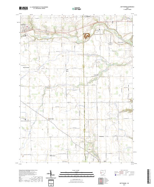
Gettysburg and the surrounding farmland of western Ohio are defined by a network of drainage ways and small rural centers. The terrain is etched by the meandering course of Greenville Creek, which flows eastward past local landmarks like Cromer Cem and Greenville Creek Cem. This area reflects a stable agricultural pattern where small crossroads and hamlets such as Union Corners, Red River, and Painter Creek served as focal points for the farming community.
Find a feature on this map
100 named features on this map. Tap any name to fly to it.
Don’t see what you’re looking for? This feature index may not catch every label — zoom into the map to look around manually.
Map Details
Date Portrayed2023
Date Published2023
PublisherU.S. Geological Survey
Map TypeTopographic
Scale1:24000
Physical Dimensions24 x 29 inches
Editions of this 2023 Gettysburg Map
This is the sole edition of this map. No revisions or reprints were ever made.
Historical Maps of Union Corners Through Time
Featured Locations
Source Details
SourceU.S. Geological Survey
CopyrightPublic Domain