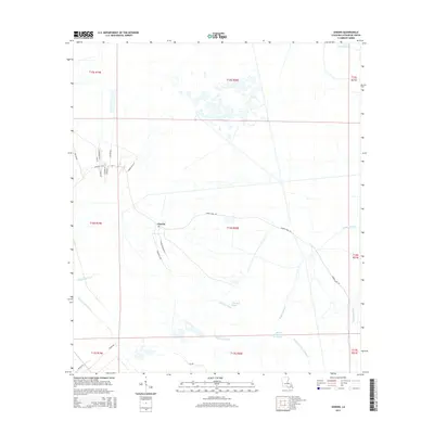
2015 Map of Gheens
USGS Topo · Published 2015About this map
The low-lying wetlands of Lafourche Parish define this landscape, where the settlement of Gheens sits at the intersection of land and water. The community's agricultural and industrial heritage is reflected in infrastructure like Sugar Mill Rd and the prominent Gheens Main Rd, which follows the natural contours of the high ground. The area is heavily influenced by a complex network of natural and man-made waterways, including the Company Canal and Forty Arpent Canal, which were essential for drainage and transport in the coastal marsh. Natural drainage is provided by a series of slow-moving bayous, such as Bayou Vacherie, Petit Bois Bayou, and Bayou Chateau De Cypres. This 2015 survey reveals how modern residential developments like Cypress Villa Ln and N Dominique Dr have integrated into a terrain historically dominated by sugar production and wetland management.
Find a feature on this map
32 named features on this map. Tap any name to fly to it.
Don’t see what you’re looking for? This feature index may not catch every label — zoom into the map to look around manually.
Map Details
Editions of this 2015 Gheens Map
This is the sole edition of this map. No revisions or reprints were ever made.
Other maps of this area

1891 · Hahnville
USGS Topo · 1:62,500

1892 · Lac Des Allemands
USGS Topo · 1:62,500

1892 · Cut-Off
USGS Topo · 1:62,500

1892 · Houma
USGS Topo · 1:62,500

1932 · Houma SE
USGS Topo · 1:31,680

1932 · Lac Des Allemands SE
USGS Topo · 1:31,680

1932 · Houma NE
USGS Topo · 1:31,680

1932 · Hahnville SW
USGS Topo · 1:31,680

1939 · Cut-Off
USGS Topo · 1:62,500
1939 · Houma
USGS Topo · 1:62,500