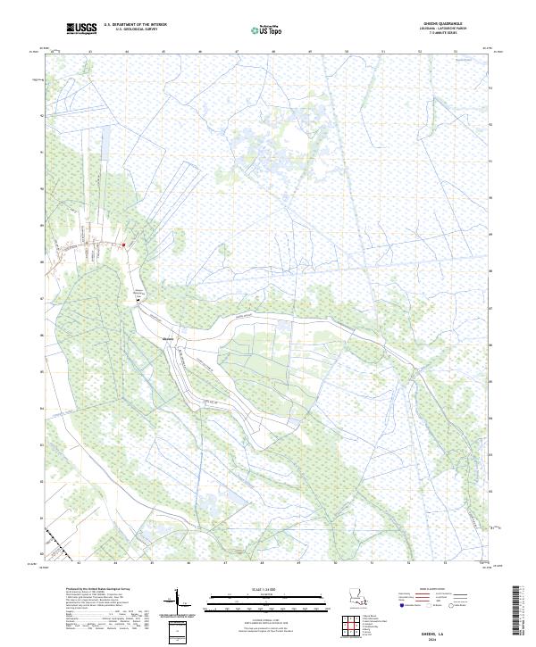
2024 Map of Gheens
USGS Topo · Published 2024About this map
Gheens and its surrounding wetlands define this modern survey of the Lafourche Parish landscape. The settlement is centered at the junction of State Rte 654 and Gheens Main Rd, serving as a cultural anchor for the local community and home to the Gheens Presbyterian Cem. This map illustrates the vital intersection of historical industry and hydrology, where land use follows the natural high ground and engineered waterways.
Find a feature on this map
34 named features on this map. Tap any name to fly to it.
Don’t see what you’re looking for? This feature index may not catch every label — zoom into the map to look around manually.
Map Details
Editions of this 2024 Gheens Map
This is the sole edition of this map. No revisions or reprints were ever made.
Other maps of this area

1891 · Hahnville
USGS Topo · 1:62,500

1892 · Lac Des Allemands
USGS Topo · 1:62,500

1892 · Cut-Off
USGS Topo · 1:62,500

1892 · Houma
USGS Topo · 1:62,500

1932 · Houma SE
USGS Topo · 1:31,680

1932 · Lac Des Allemands SE
USGS Topo · 1:31,680

1932 · Houma NE
USGS Topo · 1:31,680

1932 · Hahnville SW
USGS Topo · 1:31,680

1939 · Cut-Off
USGS Topo · 1:62,500
1939 · Houma
USGS Topo · 1:62,500