2022 Map of Gholson
USGS Topo · Published 2022About this map
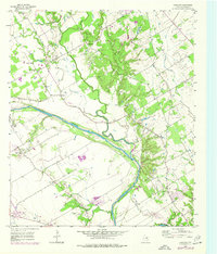
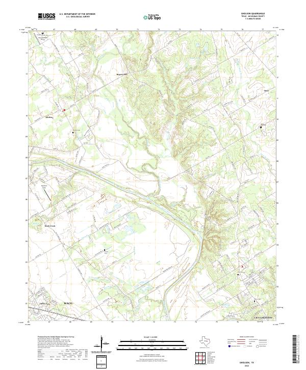
The Brazos River carves a sweeping path through this McLennan County landscape, defining the boundaries and drainage patterns for settlements like Gholson and Rock Creek. This 2022 survey illustrates a region where rural heritage remains visible through numerous family and community burial grounds, including the Gholson Cem, Crump Cem, and Zion Hill Cem. The land is dissected by an intricate network of tributaries such as Aquilla Creek, Elm Cr, and Salem Br, which feed into the primary river valley.
Find a feature on this map
163 named features on this map. Tap any name to fly to it.
Don’t see what you’re looking for? This feature index may not catch every label — zoom into the map to look around manually.
Map Details
Editions of this 2022 Gholson Map
This is the sole edition of this map. No revisions or reprints were ever made.